Sequoia, Kings Canyon and Yosemite National Parks

This Country Is So Gosh Darn Beautiful, Part II

A visit to these three California national parks, all located high in the Sierra Nevadas, is a visit to some of the most beautiful places on earth. Each one has its own charm and will be discussed separately. Each one is deserving of this sub-title.
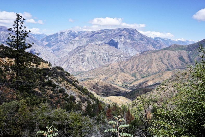
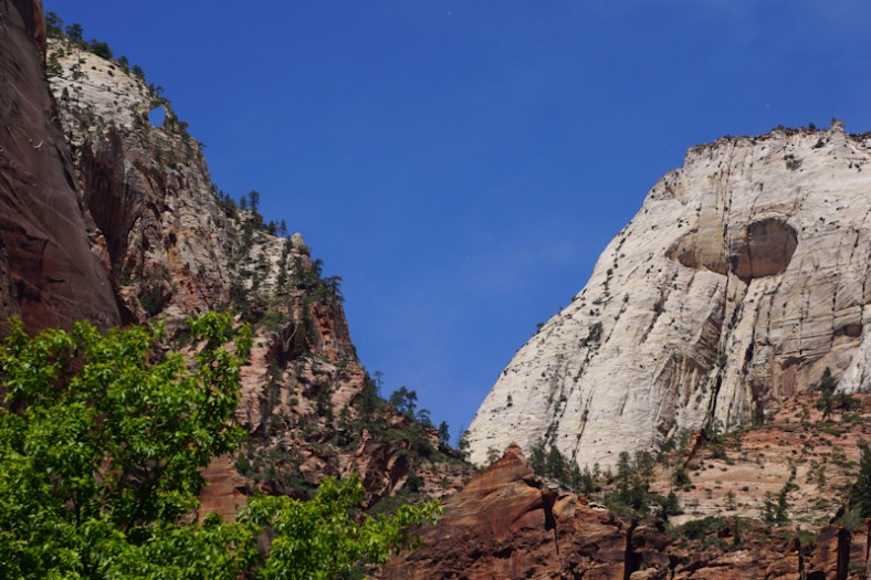
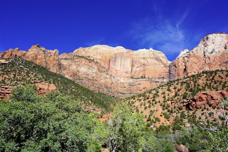
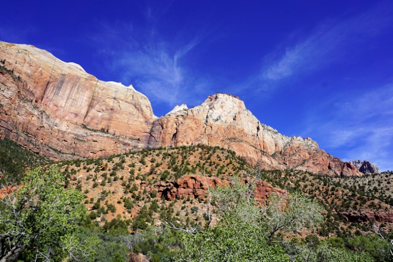
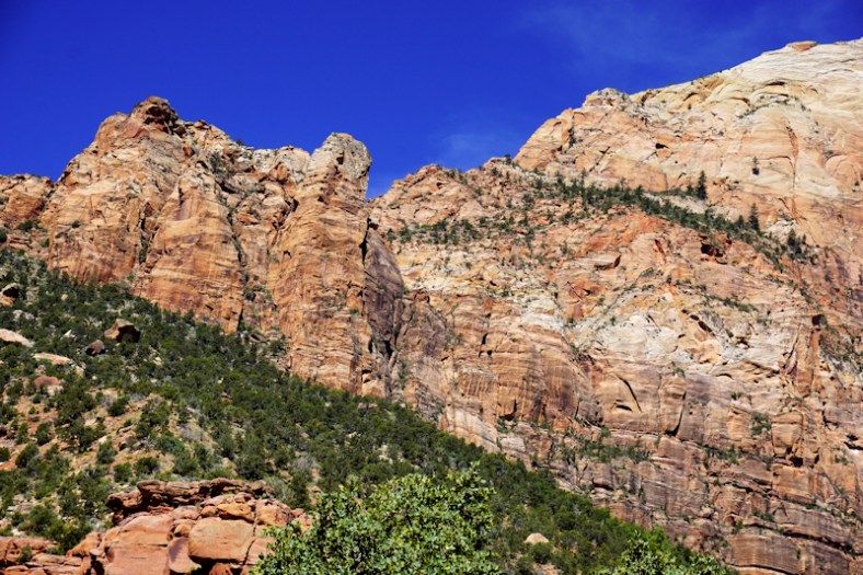
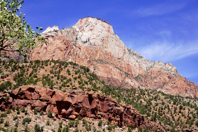
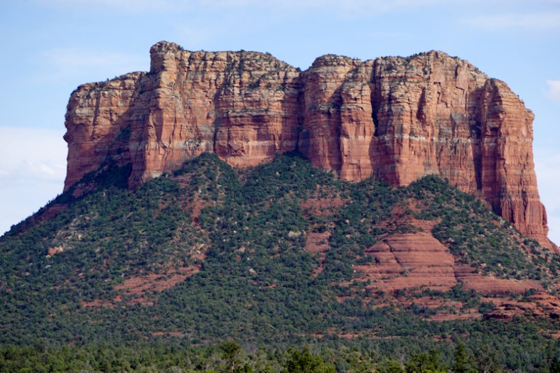
Sequoia

While we were here, it was freaking cold out! Like in the upper 30’s and no sun. The reason for this is because of the extreme elevation of the area (5,000 to 7,000 ft.) and also the weather pattern at the time. But, we were actually high up IN THE CLOUDS themselves! We can see the temperature change 30 degrees as we traveled through the switchbacks up to the Visitor’s Center and beyond. Visibility was near zero at times so driving and sightseeing was hard. Forget about an outdoor picnic! We had to abandon all of our plans and eat concession food indoors and limit our time outdoors due to the cold, damp weather. Brrrr. You needed winter clothes and mittens/gloves!

IMG_20170611_164615

Note the cloud fog caused by being in a cloud. Size compared to fence and bus behind.

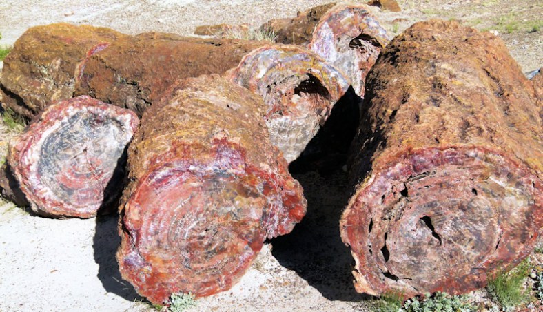
The park has the largest sequoia trees in the world. They only grow in this narrow range of elevation. They live to more than 3,000 years old. Their wood is NOT useful for anything. They can easily survive fires.
P1030954
sequoiaI wish we could have enjoyed the outdoors more while high up in the park. Hiking and biking were definitely not on our agenda for the day we had to spend here.
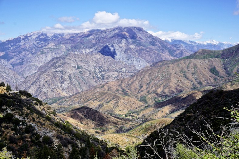
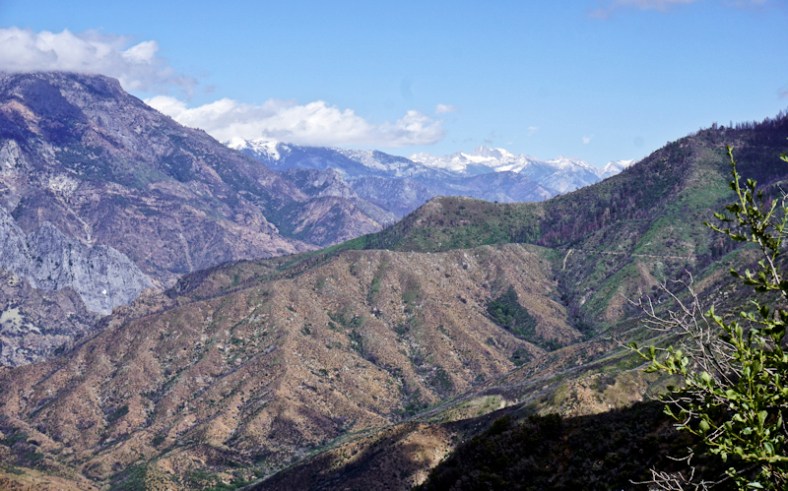
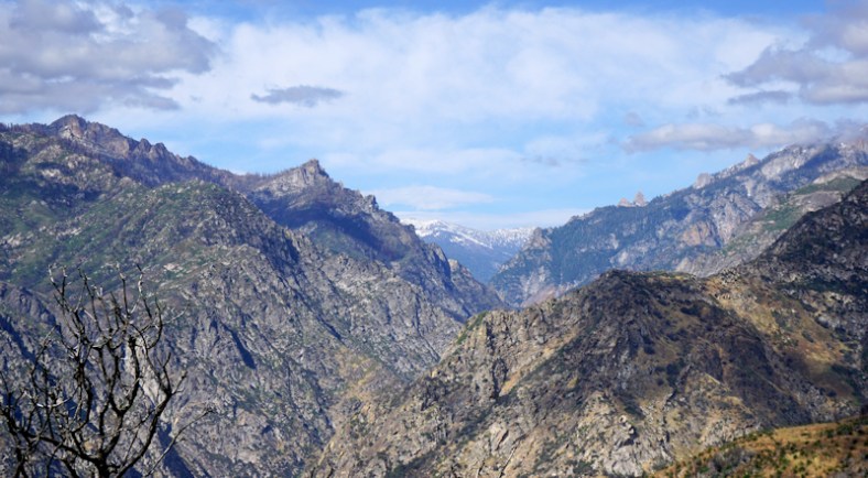
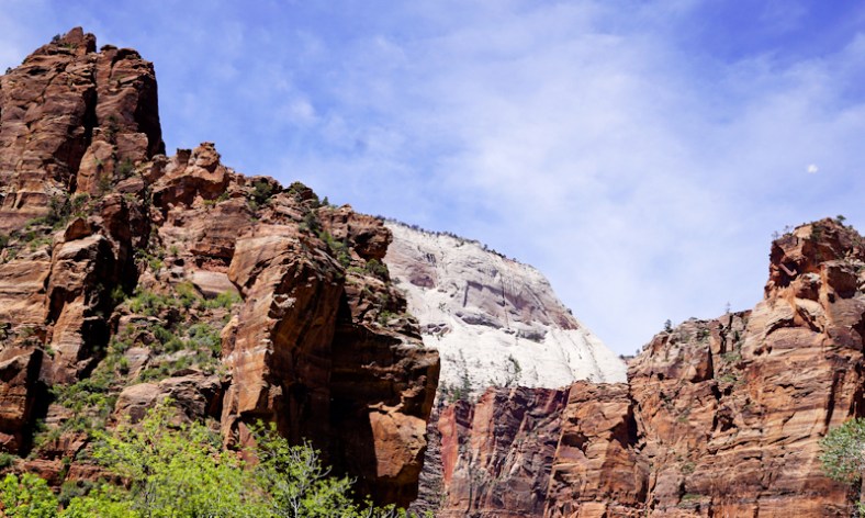
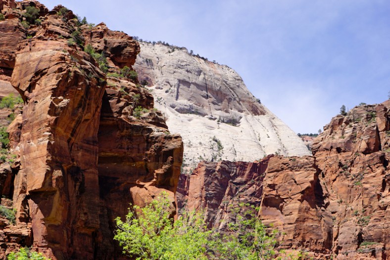
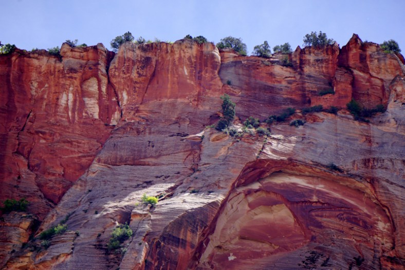
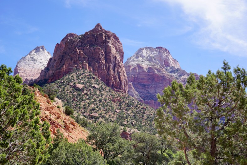
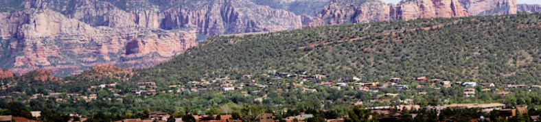
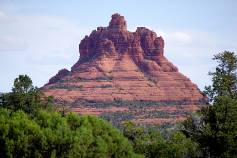
Kings Canyon

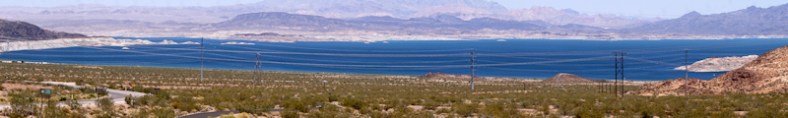
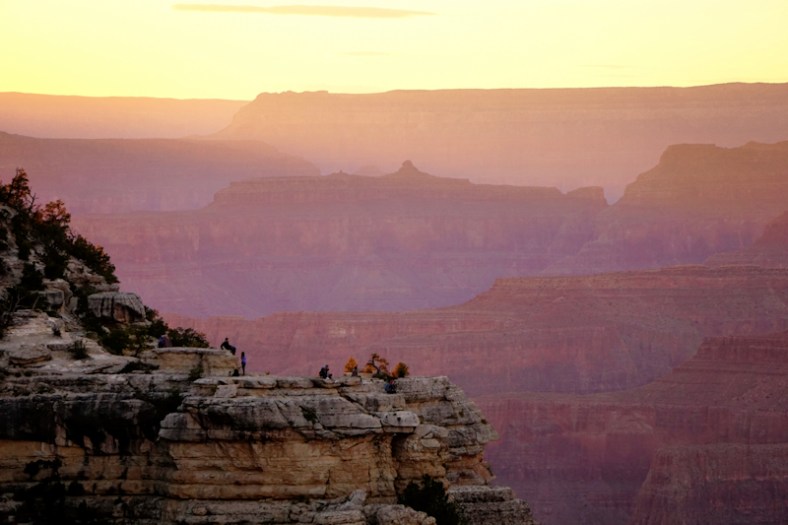
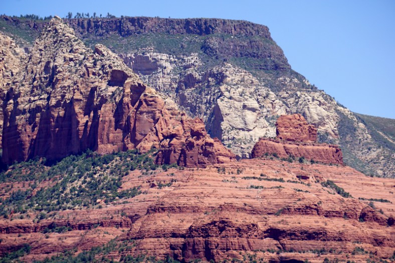
Again, this is so dependent on elevation for your comfort factor. But, our plan was to do the 20 plus mile gorgeous drive through the the canyon to the end (eastward) and back, which would be a good part of the day. We would also spend some time at Gen. Grant’s Sequoia tree, which is over 2,000 years old. It’s not quite as high in elevation here nor as cold and into the clouds. By the way, while we are experiencing some cold weather in these parts, word is that Yosemite is experiencing some SNOW!

Here’s the General Grant Sequoia tree:


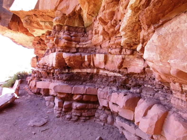
Here’s a hollowed out tree as a tunnel:
DSC01746
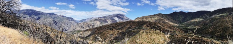
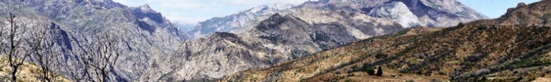
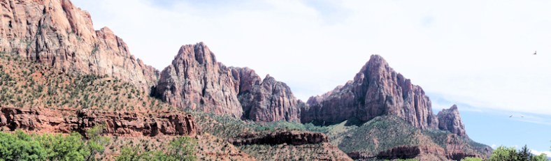
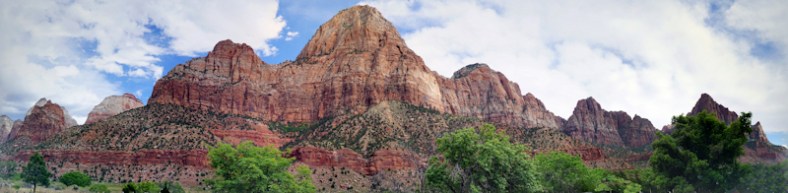
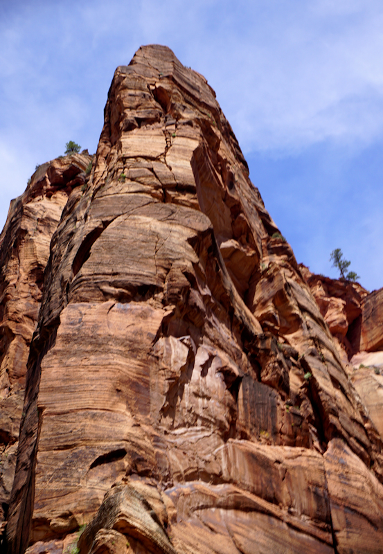
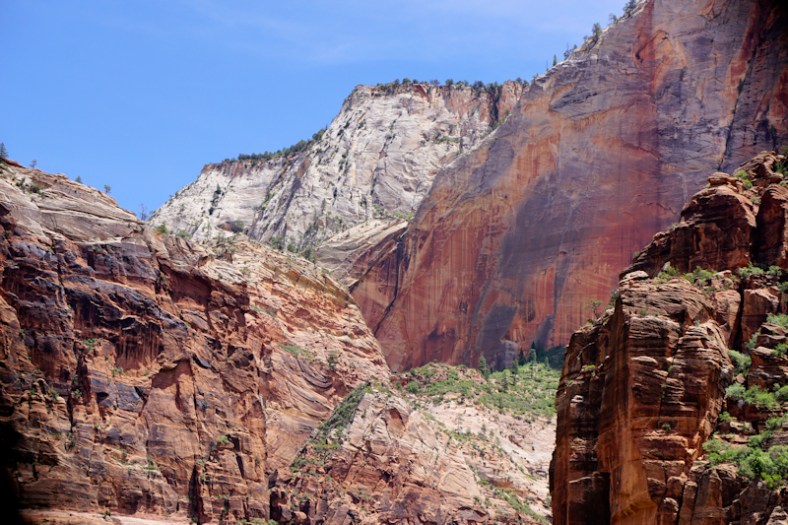
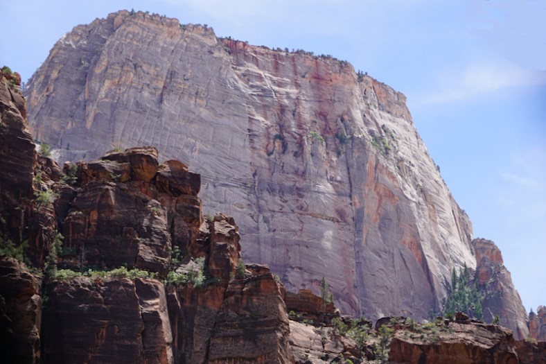
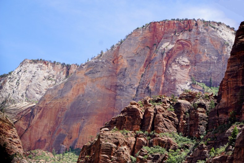
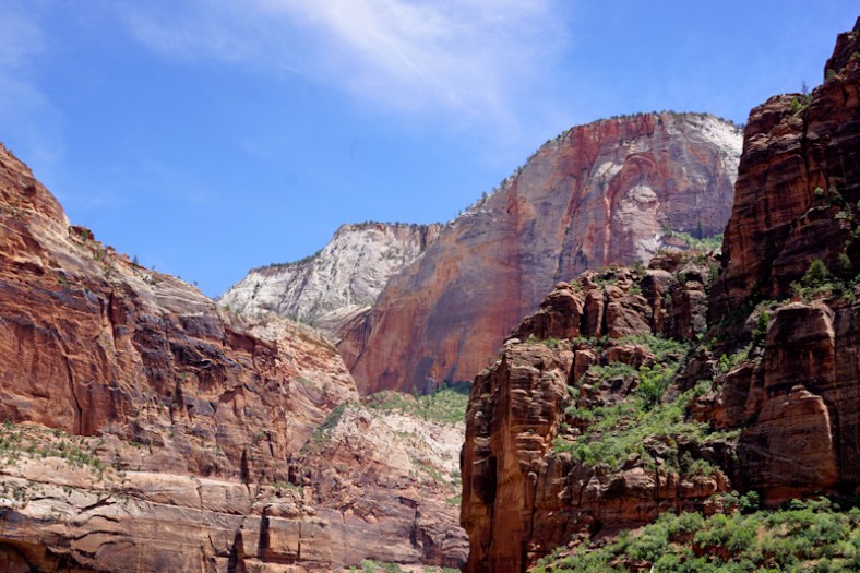
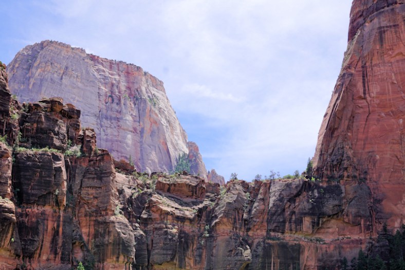
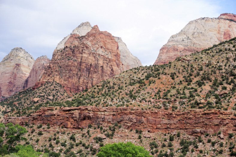
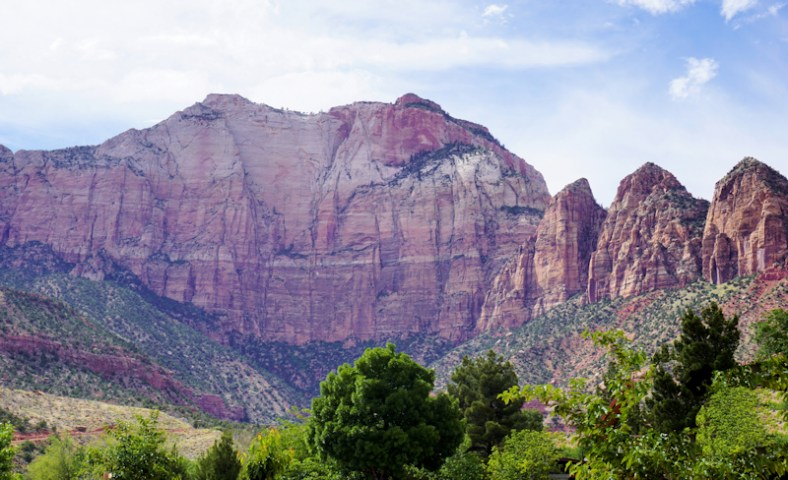
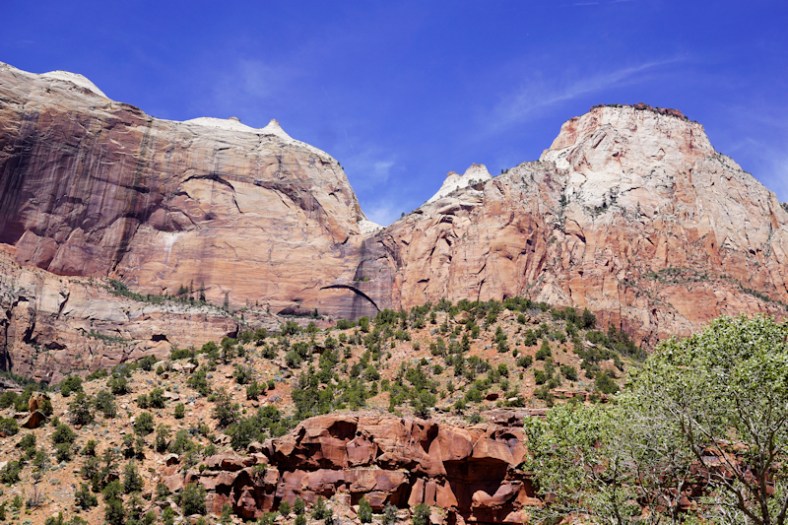
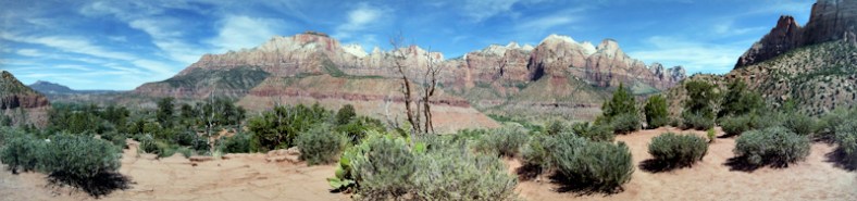
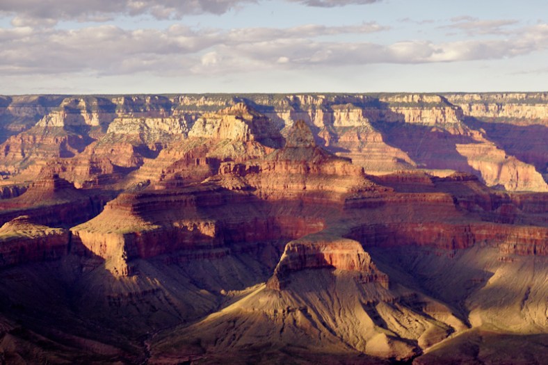
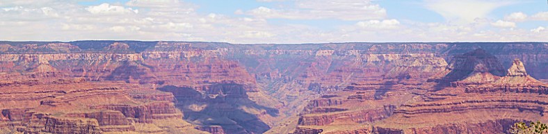
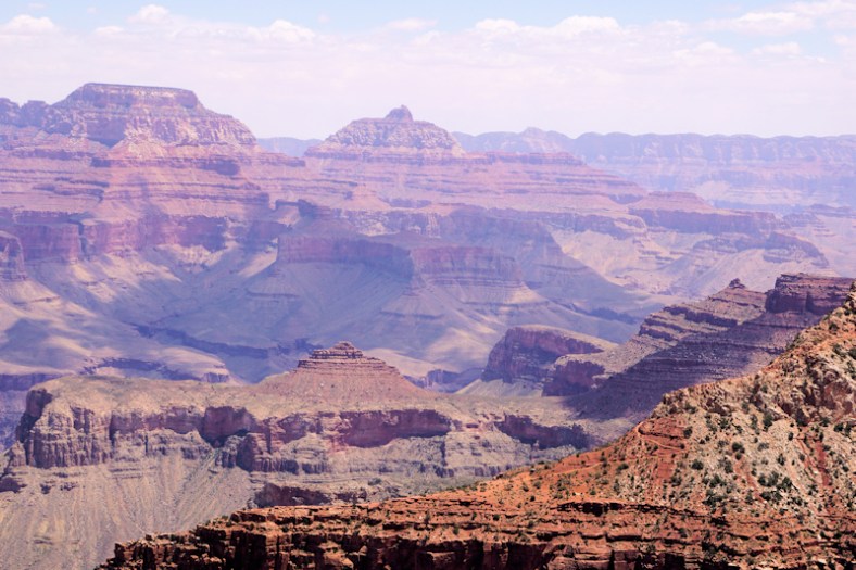
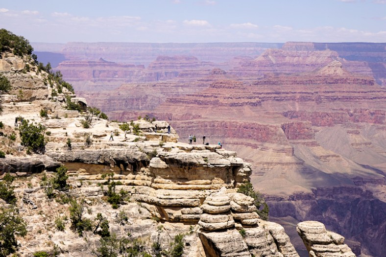
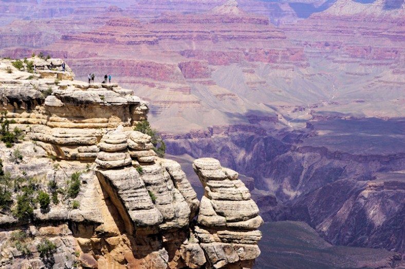
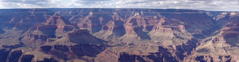
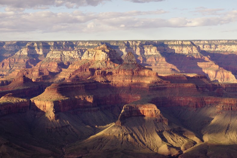
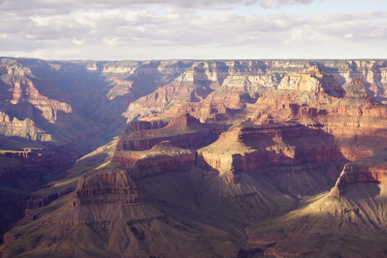
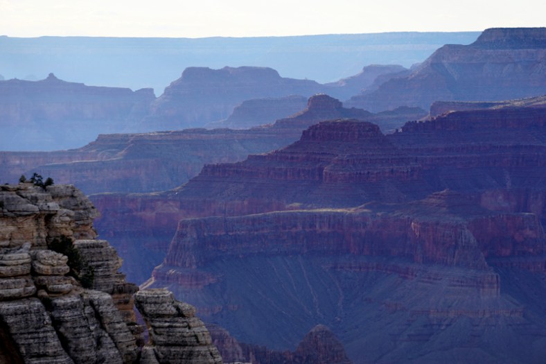
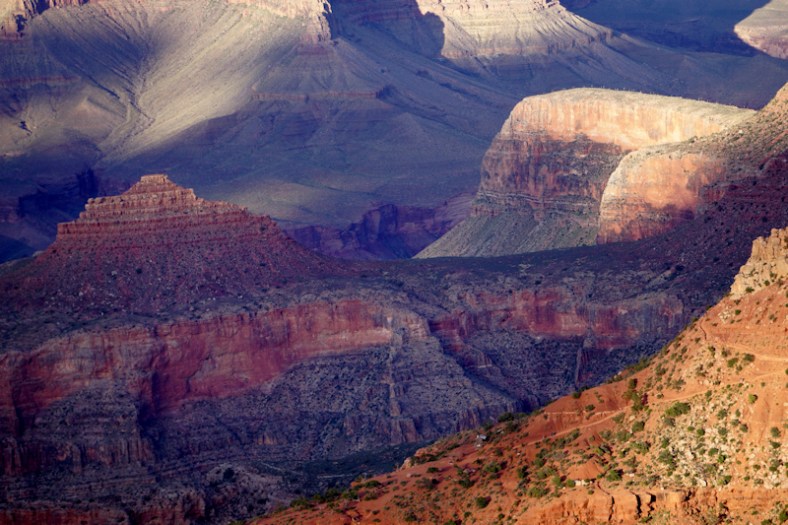
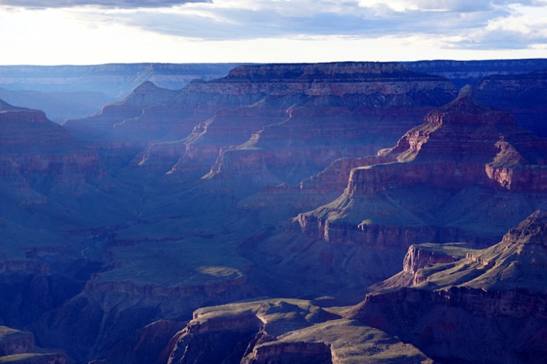
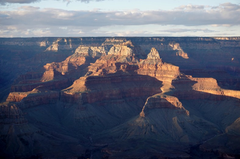
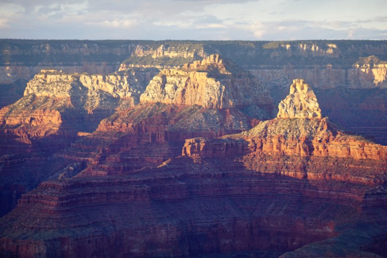
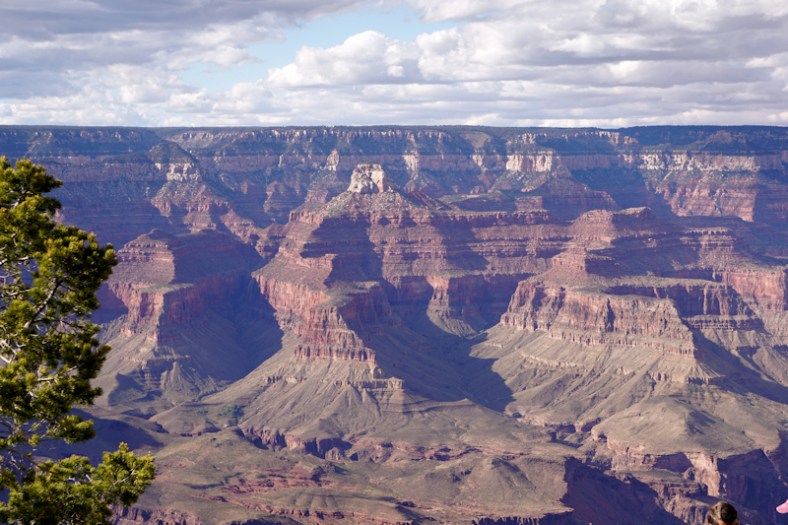
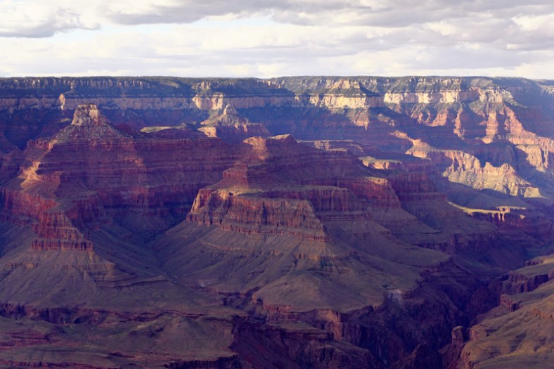
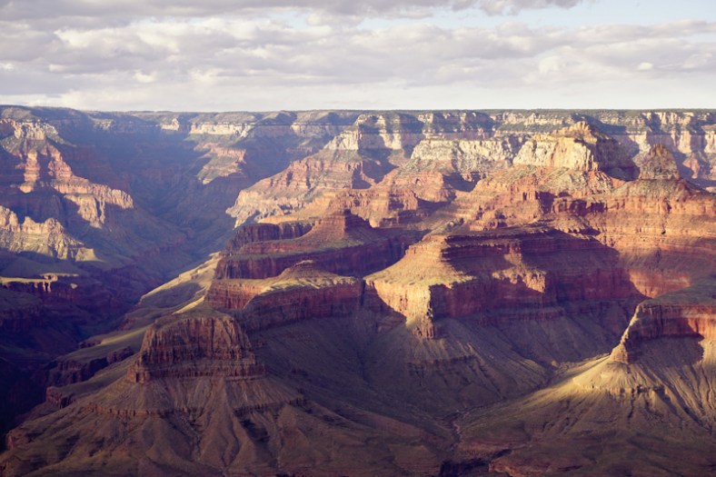
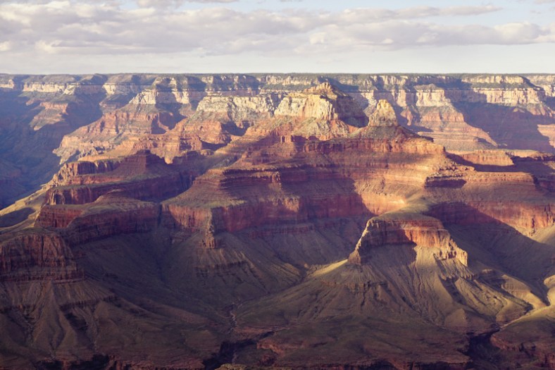
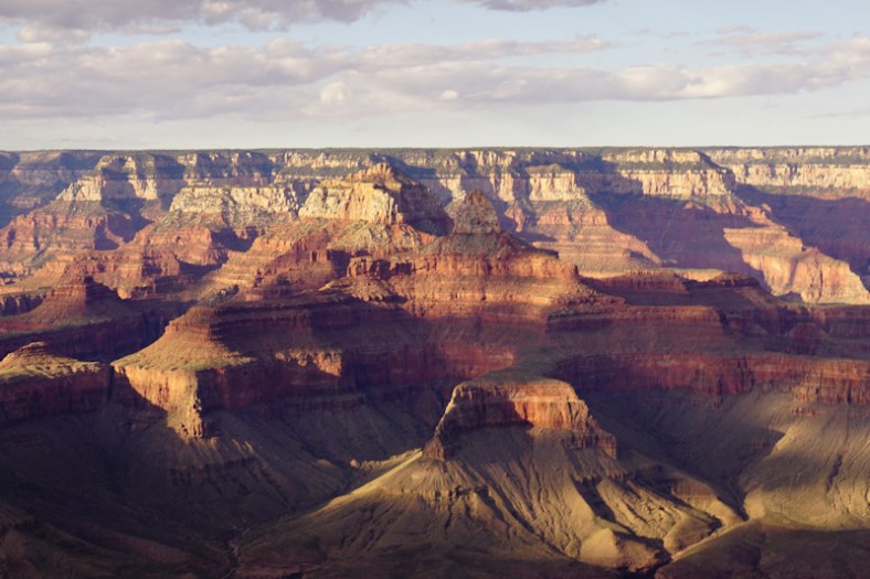
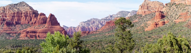
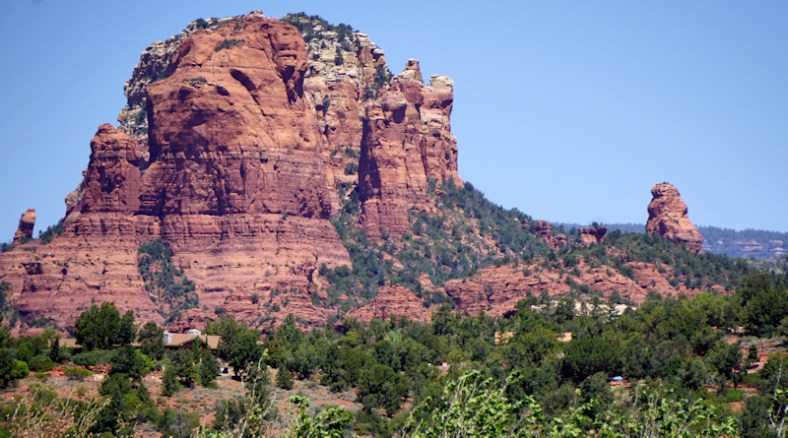
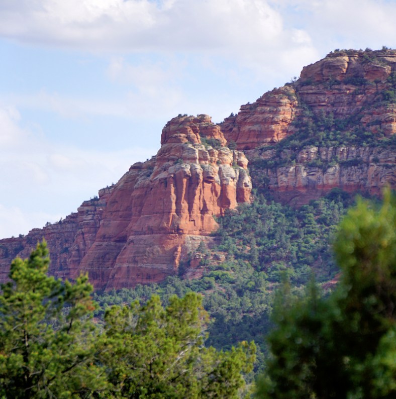
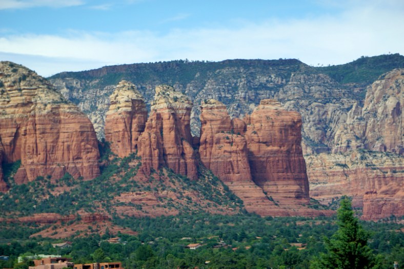
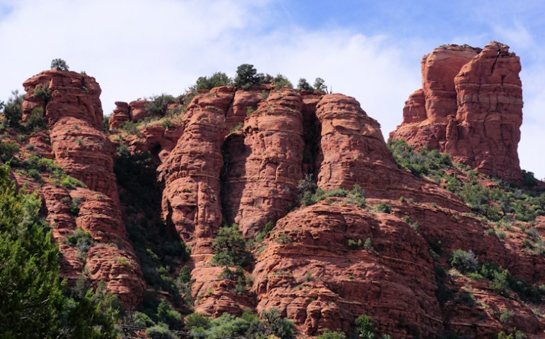
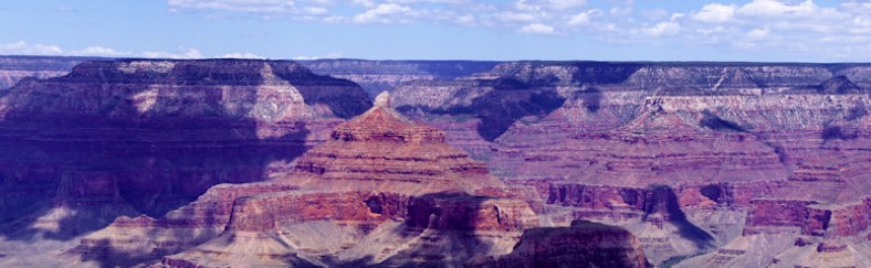
Our drive through the Canyon was absolutely spectacular. It was on my birthday and was the best birthday present. Ken drove east, while I did the drive back to our motorhome. Here’s my photo essay after these two panoramas:

kings7
kings6

kingskings1kings3kings4

kings5

DSC01794

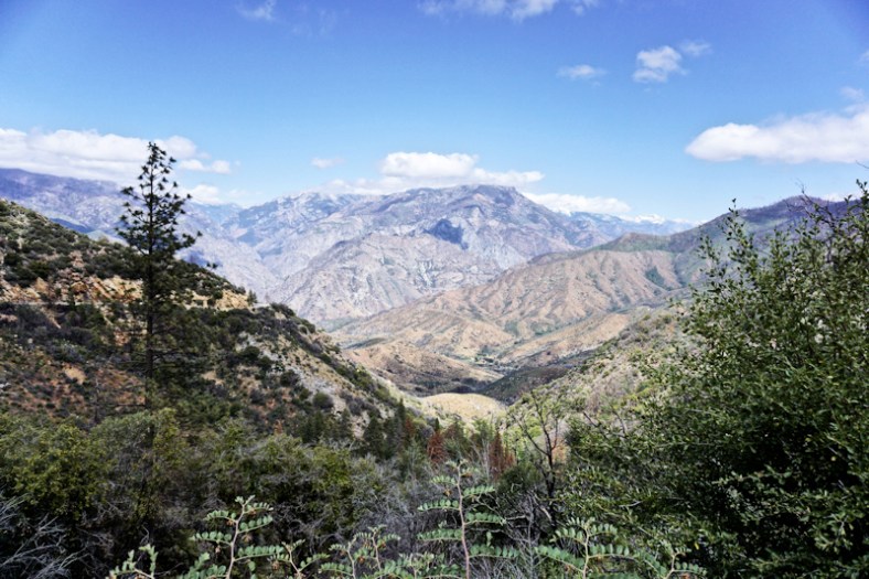
We captured many waterfalls, and will be its own subject post next!
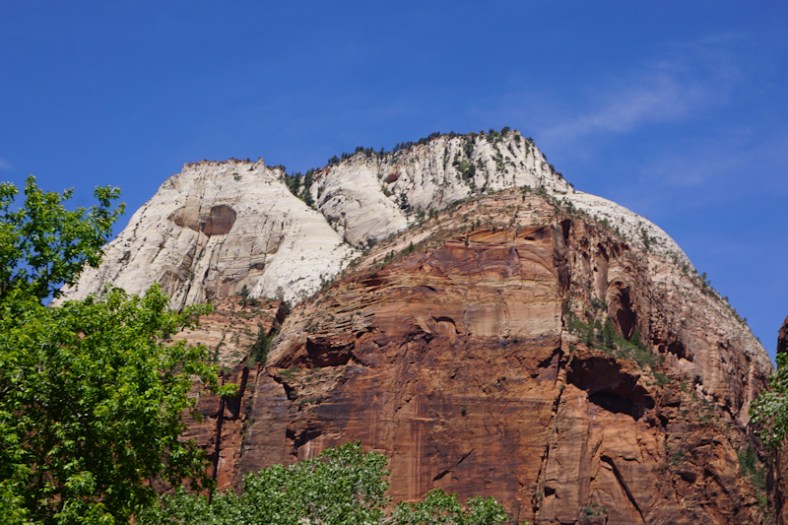
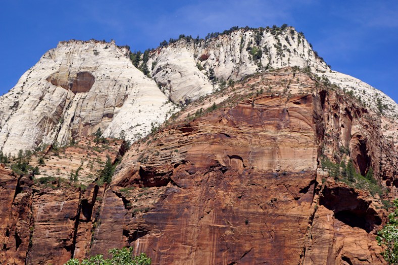
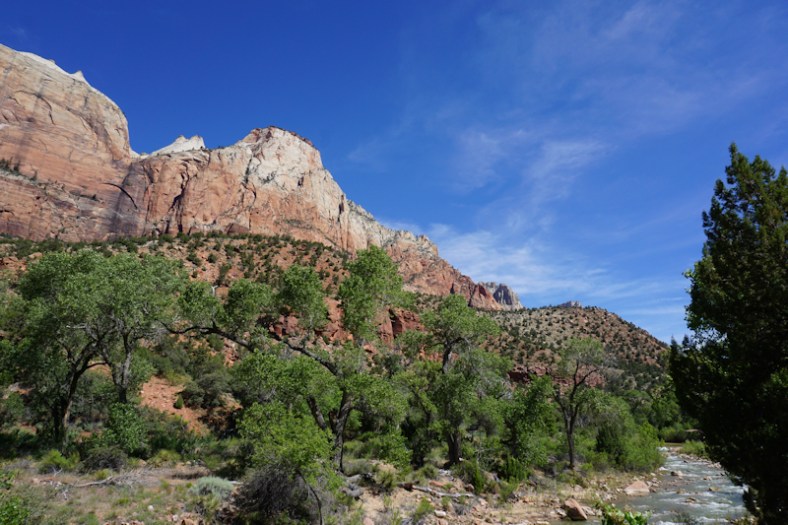
Yosemite

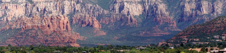
By the time we got to Yosemite, the weather improved and became quite pleasant in the higher elevations. What was rather shocking to us, though, was the travel time from our campground to the main Visitor’s Center in the Yosemite Valley: a whopping 2 hours with normal traffic! It was about 20 minutes longer due to road repairs. Had we booked at another campground on another route into the park, we would’ve been in much worse shape because a rock slide closed that route’s entry in and added an additional 45 minutes travel time for that route. The only campgrounds with decent commutes are the inner park campgrounds without services. We stayed in the small town of Coarsegold. Close by was the larger town of Oakhurst with access to shopping and services, at 8 miles away. It was here that I was able to get a decent haircut at a decent price.

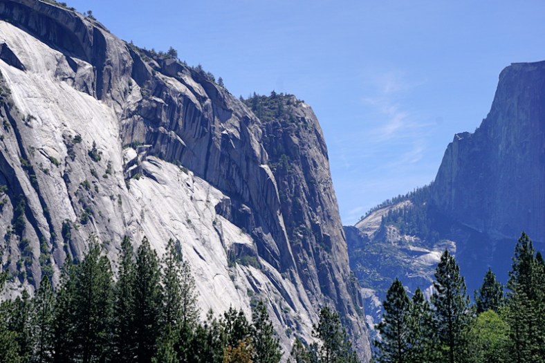
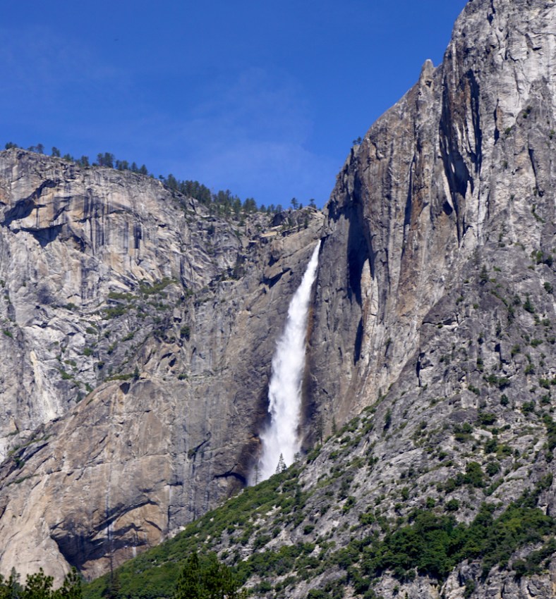
As mentioned above, we’re saving everything having to do with waterfalls for our next post. The following photos will show off Yosemite minus the waterfall features it’s so famous for (except for one). We took the most beautiful bike ride ever at Yosemite. They have wonderful walking/biking paths.

yoz

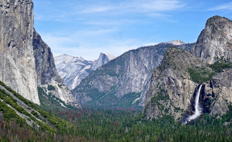
Yosemite Valley. Post tunnel viewpoint with el Capitan, Half Dome and Bridal Veil falls

yoz1

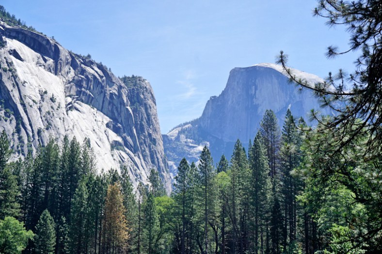
Half dome on right. Taken during our bike ride.

yoz3

Different view of scene above

DSC01855

yoz4

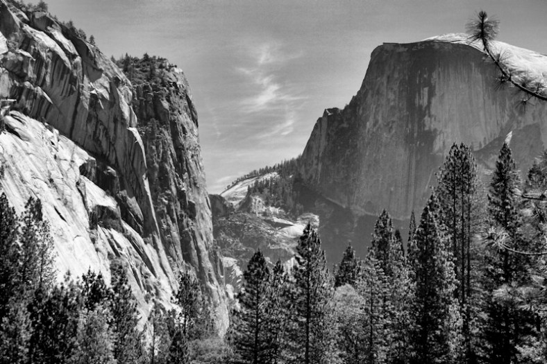
A little bit of Ansel Adams’ inspiration!

Our dear friend, Susan Helbert, said we’d love Yosemite and she was absolutely right. We also met up with Deanna and Brad while we were there. Deanna worked for us for many years. They were visiting from Hawaii.

So, our next post will cover everything waterfalls. After that, we head to Lassen Volcanic Park and on to Oregon!


Kite Boarding at Pismo Beach, CA

On the last day of May we were staying at Pismo Sands Campground, at Pismo Beach, CA. This part of California is ideal for kite boarding, especially during the Spring. Ellen and I wandered down to the town beach each having our own cameras. The strong, cold sea breeze for this particular day was blowing 25-30 knots gusting to 35. Ellen had only brought a light jacket forcing her to retreat inland. The wind blew the fine, almost powdery sand to such an extent that my first shots were my best. After the first 10 minutes my glasses became so covered with salt and sand that I had to quit because I could not see through the camera!

I will show you some photos of the kites and boards but the video  only shows the kite boarder (please click on this Link.). The reason being is that the kite is so high in the air that if I showed both, I would be so far from my subject that there would be no details. To illustrate the problem, look at this photo.

Kite and boarder sm

Kite boarder and kite. Note the lack of detail. Also note the robust sea conditions.

It was extremely difficult to hold the camera still, particularly as I zoom closer to the kite boarder.

The following photos show the kite boarder balancing his weight against the lift of his kite.

brian

The kite boarder is clearly in control and is enjoying every moment of this ride!

brian2

Creating his own spray.

brian3

Airborne! You can see water spilling from his board.


Deserts, Dams, Mountains, and the Pacific Ocean

Over the time span of a few days, we spent time in many different terrains! After Zion, we camped in the desert of Willow Beach, part of the Lake Mead National Recreation Area. It is a recreation area because the man-made lake was created by the Hoover Dam so that electricity can be generated by the dam while controlling the flow of the Colorado River. Our campground was on the River.

mead

View from the hill of our campground of the Colorado River

We were here the week before Memorial Day weekend and it was already very hot, close to 100 degrees! There were no shade trees at our campsite.

While there, we toured the Hoover Dam. It is enormous in scope. I remember reading about it in history books as a student. I didn’t realize then how important it was for its electric power generation.

P1030606

Hoover Dam at the Colorado River upstream side

DSC01548

Generating Electricity in the Power Plant Within Hoover Dam

P1030623

Statue of Dam Worker

P1030603
The photo above gives you a sense of scale of size for the dam. The river is below out of sight of the photo.

The recreation area created by Hoover Dam: Lake Mead and Lake Mojave are beautiful blue gems arising from the barren desert that surrounds it.

mead2

Lake Mojave Panorama

mead3

Lake Mead Panorama

Next we traveled to the Angeles mountains of California to a small Canyon town of Acton. We stayed at the Californian RV Resort over the extended Memorial Day weekend. We were on the dry side of the mountains, so we were seeing desert-like landscapes but mountainous in terrain. On the long trip here from Lake Mead area, we passed by Las Vegas and the entire stretch of the Mojave desert. We saw several large solar farms in the desert that date back several decades. This scenery is so totally strange to see. While in this area, we stopped at a farm animal sanctuary and learned about big business farming. I almost became a vegan on the spot, but I don’t like soy products, so I “chickened” out.

DSC01584

Ken hugging one of the rescued cows

Here’s another relevant photo op of Ken while at the Sanctuary:
20170528_124637

From the mountains, we headed west to our destination of Oceana/Pismo on the Pacific. Our first sighting of the Pacific was while driving in Ventura. We visited Pismo Beach on a really windy day and Ken got some great shots of someone kiteboarding.

brian

After our stay in the Oceana/Pismo area, we moved north up the coast to Morro Bay, where we stayed in a campground very close to the famous iconic rock (rock is right behind). It was also a short walk/bike ride into town and the waterfront from here.

20170602_122549

Photo taken from our campground. Bridge to Main street on waterfront

morro

Panorama from atop of mountain at Morro Bay State Park

Note the hazy fog in the photo above. That is often the case around here. Also, this is a natural harbor as the land forms an isthmus to the rock.
morro1

morro2

Note the black schooner in the center

In town, Giovanni’s fish market had great smoked fish. There were lines on a weekday at 4PM to get seated at a table. We bought smoked yellowfin tuna and calamari salad to go.
20170603_161728
Since Jen is a wine club member of Cass Winery in Paso Robles (nearby wine country), she got us comp tickets for a members only dinner under the stars for June 2nd. It included 2 glasses of wine and star gazing with telescopes from students at Cal Tech. It was a fun event.

Morro Dunes was also our base for visiting Moonstone Beach to the north in Cambria and San Simeon for the Hearst Castle. At the castle, we had guided tours each which lasted a little over an hour in total time. Here’s a slideshow of the castle:

This slideshow requires JavaScript.

When at Cambria, we enjoyed our walk on Moonstone Beach, named for the type of stones which can be found there.
20170604_133715
While in the cute town of Cambria, we ate at Linns, famous for their pies.

Next post will cover Marina in the Monterey Bay area.


Zion Canyon Is About Looking Upwards

This entire area is phenomenally gorgeous. It’s one beautiful vista after another. Imagine the red rocks of Sedona, Arizona on super steroids. The entire length of the canyon/park is special. Springdale, Utah is the town surrounding the park’s entrance. The Virgin River runs through the park. Our campground, Zion River Resort, was located in Virgin and the river runs through the back of the property.

zion2

Virgin River surrounded by high sided red walls!

The drama of the Grand Canyon was about the vastness looking outward and down. The drama at Zion is about the vastness looking outward and up. All of the major points of interest in the park had been given biblical-inspired names by the Mormons who settled in the area, including the river’s name (wink, wink). It’s easy to interact with your surroundings here with many suggested hikes from easy to difficult. Some are even handicap accessible. During the main tourism season, the scenic canyon drive is closed to vehicular traffic and shuttle buses provide the mode of travel from vantage points to hiking trails and visitor’s services. I shot so many photos, I want to share them all. Ken also went on a more strenuous hike than what I could do so he will share his separately.

zion3

Panorama to get things started

zion34

Another one!

zion18zion19

zion20

Close up of the photo above this one. Those are pine trees on top!

zion21

Same series to the left

zion24

zion25

Close up of the photo above this one

zion26zion27zion28
zion29zion30zion31zion32zion33

Are you getting the feeling that this place is paradise? Well, here are more photos to help convince you if you haven’t made up your mind yet:

zion12zion13zion14zion15zion16

zion17

Virgin River on the right

zion18zion22zion23


Ken’s Hike

“I  decided to take one of the hikes labeled as the Watch Tower. The following view is from the top. The difficulty was listed as medium. The path is very clearly marked and it was a perfect challenge for me. It was steep enough to give me a sense of accomplishment without exhausting me. The drop offs are steep and a misstep could be fatal, although the path is wide enough that it should not be a problem. Building this trail must have been difficult. Erosion of the trail by the occasional violent storms was part of the planning. Along the path stones are placed diagonally across to the path and angled downward to channel rain water to careen down the cliff rather than down the trail.
zion35

Note how the rocks on the trail form a shelter almost resembling a prehistoric bus stop.

trail2 sm

Notice the subtle changes in color of the various strata

Zion is a study of erosion. Most of the rock is jagged, but some are smooth, caused by moving water. This gives the rock the look of melted plastic or exotic pottery.

And then there is the contrast between the comical commercial aspect of the area and the almost ethereal beauty. This is outside the park. Much praise to the National Park Service for their care, maintenance and passion for educating the public of the beauty of this area.”

sublime redicu sm

From the sublime to the ridiculous!


Each day at the park, we were able to park our car in town and grab the shuttle to the Park’s Visitor Center. Ken enjoyed some brews (a flight) at the local brewery in Springdale. I found a beautiful necklace and earring set for Jen’s birthday at an artist’s gallery in town, made from cyan blue butterfly wings (Costa Rican butterflies).

jen butterfly jewelry

Our only regret is that we hadn’t pushed further to the east to get to see Bryce Canyon. But, it would be a two and a half hour drive away (each way); too far for a day trip.

The drive up to Zion from Williams was interesting passing through multi-colored desert scenery and miniature red rock canyons. We had two scenic/tourist stops, one in Cameron, AZ, home of the Cameron Trading Post, and the other at the Navajo Bridge over the Colorado River. The Navajo Bridge experience was a crazy one. We pulled into the driveway towards the parking area for the visit only to find out that there is no place to park our rig and tow! We had to disconnect the car, move both vehicles, parallel park, and re-hook up before leaving. This is a first! We had always worried about this happening. It’s kind of like worrying about a knockdown on your boat and once when you experience it, it’s like, okay, no big deal.

And Cameron is a small town wrapped around the Trading Post:

From Zion we head to the Lake Mead area and then on to California and the Pacific mid-coast. More posts to follow of course!

Our Grand Canyon Dream Come True

Ever since I was a child (Ken, too), I dreamed of seeing the Grand Canyon. Perhaps it was the Grand Canyon Suite or the many pictures and movies that I’ve seen of it, or stories I’ve read about how it makes you feel. After all, it is one of the “seven wonders of the world”. It has been on the top of my bucket list for as long as I can remember. All I can say now is that after seeing it live, it did not disappoint!

We wanted to stay in a full service campground, which meant staying in the cute western town of Williams on Route 66 (where you can get your gitch) at the Grand Canyon Railway RV Resort and Hotel. It’s a total of a one hour drive to the Grand Canyon Visitor’s Center. We were fortunate to be here just before the busy season begins so we didn’t have to fight crowds, but we did have to deal with some pretty cold weather, especially after the desert heat which we became accustomed to. It’s all about elevation and Williams is just about the same elevation as the Grand Canyon at about 7,000 ft. We had two nights well below freezing and one night with snow accumulation! But, the day warmed up nicely with only light jackets needed.
Here’s a slide show of downtown Williams:

This slideshow requires JavaScript.

We spent two full days at the Canyon. The first day was spent learning everything we could, and we were there quite a long time. The second day was planned to arrive there later in the day so we can get sunset photos. Both times, parking in the park was easy. Ken took the Ooh Aah Point hike (the easiest) down and back up.

gc29

View from Ooh Aah Point

Both days we brought a picnic lunch or dinner. We also used the free shuttles extensively while leaving our car parked at the Visitor Center near the Shuttle Hub. While Ken was hiking, I explored the stops on the shuttle bus.

The photos below were taken during normal daytime.

gc14

A panorama view that tries to capture the great vastness of the canyon

gc17

The foreground rocky cliffs give a sense of depth to the canyon

gc20

A sense of “grand” when seeing the scale of people on the rocks

gc7

Another view of the people on the rock outcropping

A slide show from various viewing points on our first day:

This slideshow requires JavaScript.

A photo showing the Colorado River 5,000 ft. below:
gc3

Ken enjoying the park!

Sunset Photos

Returning the next day so we could capture the sun setting in the canyon, I captured many photos which were all taken at Mather Point. This is considered the best place for the sunset photos. I was surprised at how uncrowded it was. I’m hoping you will notice many of the photos below are of the same angle and subject as some of those above and you will be able to enjoy how different the light makes them appear. It’s magical and spellbinding.

grandcanyon13

Panorama where sunset creates depth by shadows

grand-canyon1

grandcanyon2

grandcanyon3

Compare this to the people photo in the series above

grandcanyon4grandcanyon5grandcanyon6

grandcanyon7

Compare this to the other “people” photos above

grandcanyon9grandcanyon10

grandcanyon16grandcanyon17grandcanyon18grandcanyon1

I hope that these photos helped to make you feel a little bit as “high” as I felt when looking at this wondrous place. America is so gosh darn beautiful! This is just one place among many that we have and will visit in the weeks and months ahead.

This Country Is So Gosh Darn Beautiful!

I could almost cry tears of happiness!

When I was a child and my parents took me to New London, CT to the shore, I remember my Mom saying that from here onward is a very big ocean for thousands of miles away. My answer was “Oh, it’s too big for my eyeballs”. And for me, ever since, anything that was awe inspiring would illicit that same child-like answer. Well, this post is about the incredible beauty that we’ve seen in three distinct places here in the southwest: The Painted Desert/Petrified Forest, Sedona and the Grand Canyon. They’re all “too big for my eyeballs”! Actually, I’m going to only give a small hint of what is to follow for the Grand Canyon in our next post.

The Painted Desert and Petrified Forest National Park

I’d also like to start the section on the Painted Desert with a question. How many of you listened to the Grand Canyon Suite by Fernand Grofe when taking music class? One of the movements was the Painted Desert. We downloaded the piece so we could listen to it while we looked at our just-shot photos in a slide show. It was incredible. However, none of the photos could do justice to the actual feeling of being present there. This is a park that you drive through for 26 miles. It begins with the Painted Desert and ends in the Petrified Forest.

petrified7

Panorama of Painted Desert

petrified3petrified4petrified5
petrified6
Hopefully, you’ll get some idea of why this area is called “Painted” Desert.

Next on our trip through the 26 mile leg, we came upon the “tepees”:
petrified2
petrified1

Next we found an ancient stone with petroglyphs:
petrified17
We found a petrified log that formed a bridge over water:
petrified18
Lastly, we came to the petrified logs strewn about in the desert:

petrified16

petrified15

Close up of interior deposits

petrified8

Crystal deposits in a log

When we were in Las Cruces, we visited the Zuhl Museum at New Mexico State University, where they exhibited the petrified logs in their polished forms. Here are the ones from the Petrified Forest:

petrified9
petrified10
petrified11
What a fascinating and beautiful place this is. We were surprised at how few people were visiting here the day we passed through.

Sedona, a Magical Place

Our plans were to meet up with Ken’s cousin Danny and his wife Beth for Mother’s Day weekend (May 12-15) in Sedona. They live in Phoenix. Although Sedona is not a National Park, its scenery rivals that of many parks. But, first I’m going to discuss the family happenings.

Danny and Beth met us at our campground, Distant Drums (actually in Camp Verde, a 30 minute drive from Sedona) on Friday around 5PM. From there we drove our cars to Sedona so that they could check in to their Inn, and we could go out together for dinner at Elote, an upscale Mexican inspired restaurant owned by a James Beard finalist chef, Jeff Smedstad. There was an hour wait, but it was worth it!

sedona20

My dish was corn encrusted scallops

Here’s Beth and Dan enjoying their dinner:

sedona19
There’s a cookbook available by the Chef.

sedona21

The next day’s dinner was at L’Auberge, outdoors by the creek (Oak Creek). This is a Price Fixed Dinner of 3 courses. The meal was incredible. Our waiter was extremely knowledgeable, and Ken ate rabbit as one of his early courses (his first taste). I’ll admit that it was a splurge!
Creekside_Dining_Evening_web
sedona17
sedona16
On Mother’s Day, we went to a restaurant that Jen recommended in Cottonwood: Farside Bistro, a Mediterranean focused cuisine of Persian influence. This place had no special brunch going on, which was a good thing. Again, we had great food, with new tastes to try. Here’s the four of us:
sedona18

On Saturday, Ken and Danny spent almost the entire day hiking in Sedona. Ken may do a post on that adventure (or mis-adventure). They were gone from 10:15 to almost 5:30. We had to call and get our dinner reservations pushed back and were lucky they were able to fit us in an hour later. The guys got LOST. While the guys were getting lost, Beth and I went on a gallery walk through Sedona and had a nice lunch out in a courtyard cafe. I found a few galleries that I liked very much. Here are a few pieces of note:

sedona22

Turned wood with torquoise inlaid and hollowed inside

These paintings were all in the same gallery. Two from the same two artists. They are unique perceptions of landscapes.

After our Mother’s Day feast, Ken and I went on a photo shoot. I was determined to find the best of Sedona to photograph. I’ll let you, my blog readers, be the judge. It’s easy to find beautiful places to photograph in this magical land.

sedona5

Panorama photo taken while driving up to Sedona from Cottonwood

sedona6

Continuation to the right from the above photo

sedona12

sedona4
sedona13sedona11sedona10sedona9sedona8sedona7sedona3sedona2sedona1

Sedona is so awesome; we can spend a month here alone. But, there are other beautiful and interesting places to visit and the Grand Canyon is next!

gc10

Grand Canyon sneak preview panorama shot!


Las Cruces, New Mexico

This post is going to cover a lot! Have you been to White Sands National Monument?, Old Mesilla and the Movie Made There, Have You Been To Mexico on Cinco de Mayo? and the Organ Mountains

Spending a week in Las Cruces with our gracious hosts, Ken’s sister Susan and husband, Pat, whom acted as our personal tour directors covered a lot of ground! Our first daytrip:

Have you been to White Sands National Monument? Don’t miss it!

white11

White Sands is an hour’s drive from Las Cruces. Great wave-like dunes of gypsum sand have engulfed 275 square miles of desert, creating the world’s largest gypsum dunefield. The photo  above was taken around sunset in 2011. The photo below was taken around noon just a this week.
white4
Imagine saucer sledding on the dunes, or hiking the trails. The gypsum remains cool to bare feet in the heat of the day. Here are two slide shows with the sunset ones with long textured shadows and the other with high noon bright sun with little texture, just white gypsum for contrast.

This slideshow requires JavaScript.

This slideshow requires JavaScript.

Meet Susan and Pat


susan

Susan at White Sands

white7

Ken, Susan, Ellen and Pat at White Sands

white3

Susan and Ken on top of a dune at White Sands

susan-pat

Pat and Susan at our campsite (Hacienda RV Resort)

Old Mesilla and the Movie Made There

Old Mesilla dates back to the mid 1800’s. Its original buildings are all adobe structures. Billy the Kid was hung here. This section of Las Cruces rivals the Mesquite section for its antiquity. We watched a movie here in the old theater (Fountain) made by local resident, Mark Medoff, based on his play of the same name, The Heart Outright. It was filmed right here in Mesilla and at the restaurant right next door to the theater. The movie was excellent!

The bus depot in the film is actually a top restaurant in the area.
mesilla5
mesilla4

Here are a few more shops near by.

mesilla1
mesilla3

Mesquite area:

This slideshow requires JavaScript.

These are adobe built buildings. The home is the oldest in Las Cruces, I think. It is being remodeled in this photo.

Have You Been To Mexico on Cinco de Mayo?

Yup, that’s what we did! We drove an hour and a half south westward to Columbus, NM and parked our car in a parking lot just outside the border crossing to Palomas, Mexico. Our agenda was to celebrate the holiday at the Pink Store for shopping and lunch. It is just a short walk across the border.
mexico1After crossing over, we are greeted by the statue of Poncho Villa and, of course, the Pink Store.

mexico7
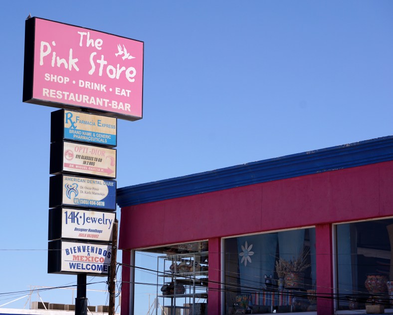
Upon entering the store, you’re given your choice of a free beverage: soda, water, margarita or beer. They have an incredible selection of stuff from Mexico and other Central American countries. There’s an entire room filled just with decorative tiles. Of course, only jewelry would easily fit in our RRRV. Here are photos of only 3 of the rooms.

This slideshow requires JavaScript.

Here’s a close-up of a humorous miniature set:
mexico19We had a really nice typico Mexican meal for lunch and wandered around town for a short time before it was time to head back over the border for home. All of our dogs were at doggie day care for the day. Here’s a slide show of some of the scenes I spotted in town.

This slideshow requires JavaScript.

Organ Mountain and Flowering Cacti

Las Cruces is well known for its prominent Organ mountain. It’s a backdrop to almost every view of the city. For me, the best time to photograph it is near sunset. The view from Susan and Pat’s backyard is also perfect because it is not obstructed. Here is my photo taken from there:
organ mts (1)
Flowering Prickly Pear and Cholla (in Susan and Pat’s yard):
chollaprickly pear

Whew! This has been an incredible week. We’ve been blessed by great company, great weather, and a great area to visit and play. Also, Hacienda RV Resort is a great place to stay!

Last Day in Pensacola and Blue Angels Show

We were treated to a most spectacular Blue Angels air show held at the Naval Air Museum in Pensacola. They do these practices every Tuesday and Wednesday when they’re in town. It’s very different than seeing the shows in Annapolis during Commissioning Week since you sit in the airfield right by the runway and listen to the announcer describe what they’re doing before and during each maneuver. You can oftentimes hear them communicate with each other! This made it much easier to set up for some good photos! I even remembered to set my shutter speed to 1/2000 of a second.

blue1

blue12

Smoky Curly Q’s


blue4
blue5P1020960

blue11

Side by Side. Bottom Photo: Upside Down

blue7blue8blue9

blue14

Twosomes and Foursomes

blue15

Awesome!

P1020966blue2blue3blue6blue10

blue13

Four Plane Deltas

We were so fortunate to be able to catch this show and to have the weather perfect for it, too! This kind of makes up for the fact that this is the first time that we will be missing the Annapolis show in 24 years!


Northern Panhandle: Highest Elevation in Florida

A little less than a two-hour drive from Port St. Joe north takes us to Florida’s highest elevation of Briton Hill at 345 ft. above sea level. We didn’t actually go there but did visit nearby at Falling Waters State Park at 325 ft. elevation. The waterfall at the park is the highest in the state at 73′, ending in a deep sinkhole.
falling waters2
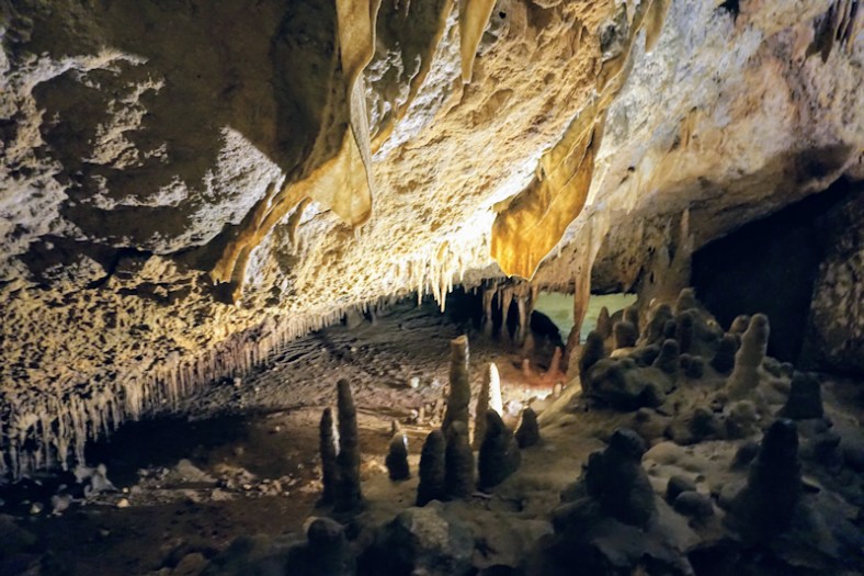
Its water flow is dependent on rainfall as well as the aquifer.  This entire area is dotted with sinkholes. While in this area for three days, we stayed at Florida Springs Campground in Bonifay. We also traveled to Florida Caverns State Park in nearby Mariana. It was really refreshing to see hills and spring sprouting with dogwoods blooming, lillies and more. It almost felt like April in western Maryland.

The waterfall:
Here is a link to the video Ken shot of the waterfall on YouTube. Here is a still shot of it.
falling waters
The caverns:
These are quite spectacular and rival the likes of Luray and others. They’re certainly less commercial since they’re part of a state park! On the grounds I was able to capture a dogwood at the end of its bloom and native wild lillies.

The best way to enjoy the photos inside the caverns is through the slide show below. Enjoy! Unfortunately, you can’t get a feeling of the size of these formations. In most instances, what you see is an area that is approximately the height of the cave, which accommodates an adult standing upright.

This slideshow requires JavaScript.

Ken and Gigi

No, I do not have a young something! Gigi is a Loggerhead sea turtle. We met yesterday by accident when I decided to go bicycling on Navarre Beach and came across her home at the Navarre Beach Sea Turtle Conservation Center. It’s a small building that was originally the visitor center for Navarre Beach Marine Park.  Gigi has her own pool.

Gigi1_FF

Gigi coming up for a breath of air.

Cathy, one of her curators, enthusiastically explains her history and you understand that Gigi is special, and this organization is special for taking care of this animal in such an unusual setting. What is more unusual is that the Gigi is blind. Cathy explained how the turtle has adapted to this condition. She does respond to voices and is curious when her caretakers clean the pool. Being able to see Gigi and learn about her individual personality made me feel privileged. Watch the video! It is not just watching another fish. Observe her as she makes her way around the pool. Occasionally you will see her using her front flippers to feel the side of the pool. My feelings toward Gigi is not unusual. Others have remarked that they feel the same way. A local canvas maker, after seeing Gigi, has become inspired to make a cloth underwater environment in part of the pool to enrich Gigi’s tactile world. Gigi has been in captivity at Sea World for most of her life, some 30 years. She was  recently acquired by this conservation center. Having an inspiration can take strange forms. Here is a statue of Gigi made of what looks like cigarette butts.

turtle model

To give you some sense of scale, I have included a photo of several common sea turtles on a chart. Gigi is about 4 foot long.turtle size

The center has other exhibits as well. The exhibits appeal to the young as well as adults.  They have several small aquariums which house local fish including some sea horses.