Yellowstone National Park: Our Nation’s First National Park

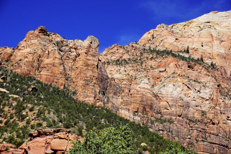
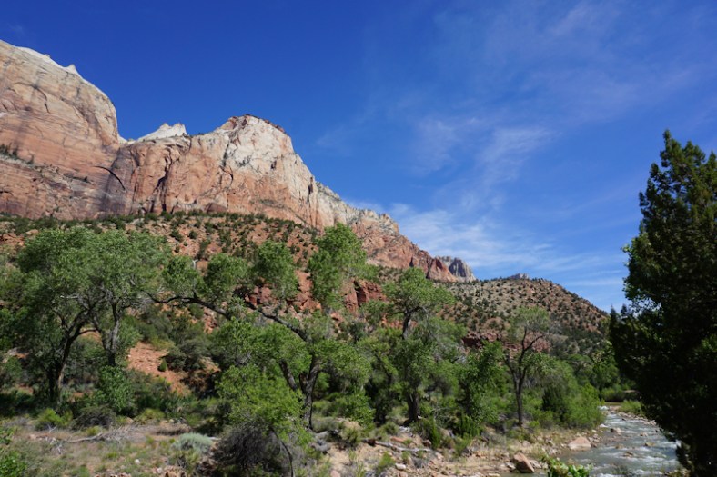
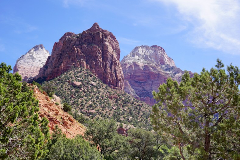
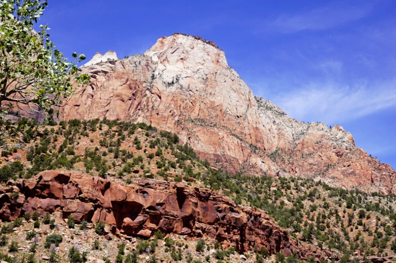
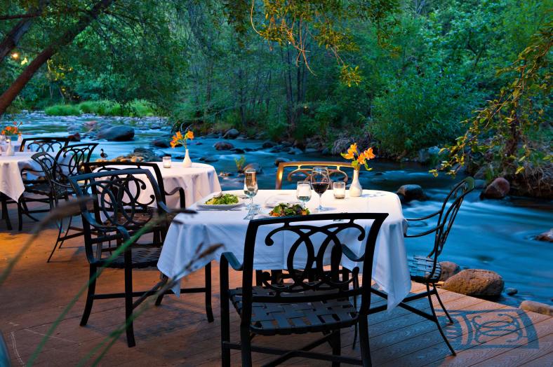
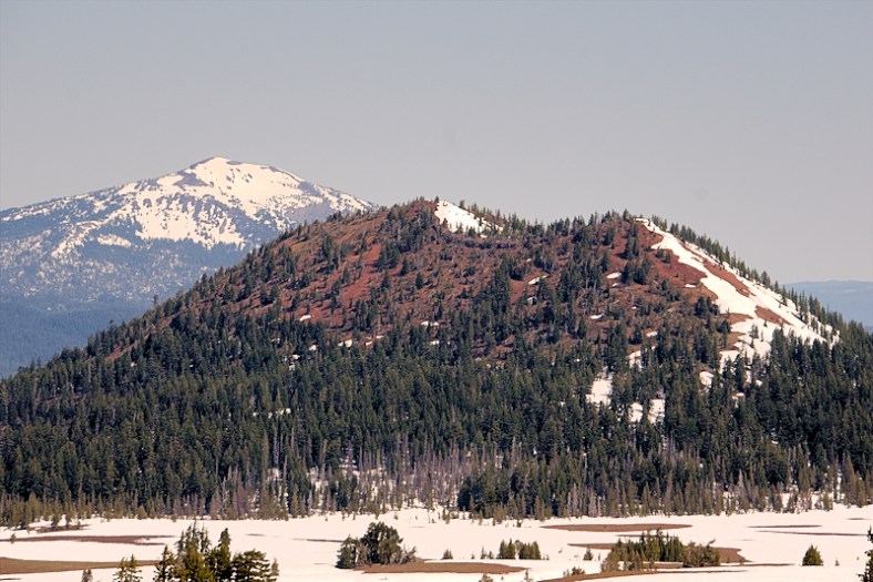
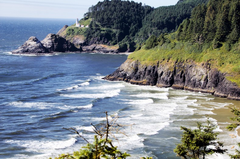
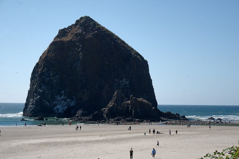
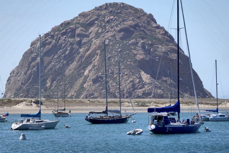
No wonder Yellowstone was our very first national park. It has so much of everything! It is geologically active with geysers and sulphur springs. It has its own “grand canyon”. It has mountainous views, prairies, rivers, waterfalls and wildlife like grizzly bears, black bears, bison, elk, moose and more. And just to its south is the Grand Teton range of mountains. The John D. Rockerfeller Highway runs north to south between these two parks.

DSC02729_edit_1.jpg

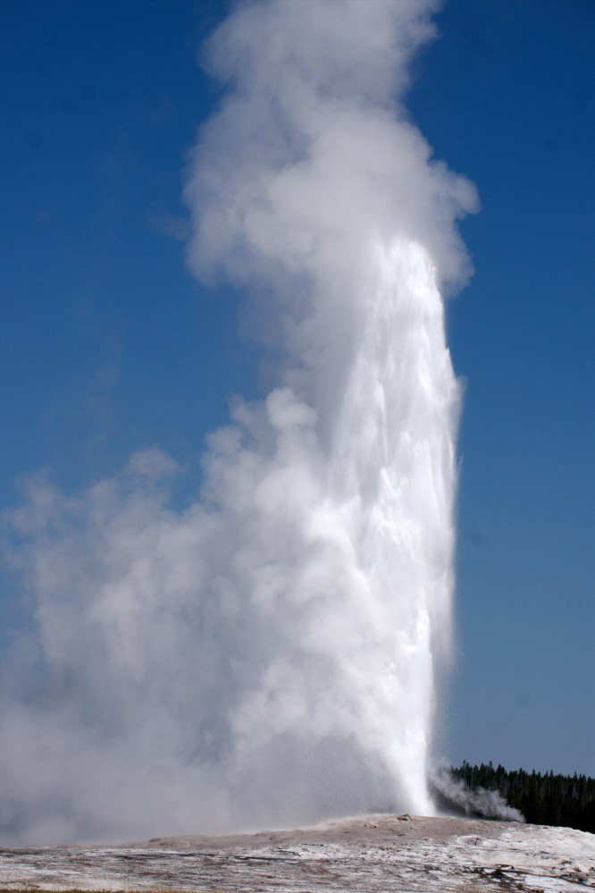
There she blows! Old Faithfull right on schedule!

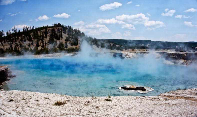
We encountered several sulphur fields and springs. Here are some:

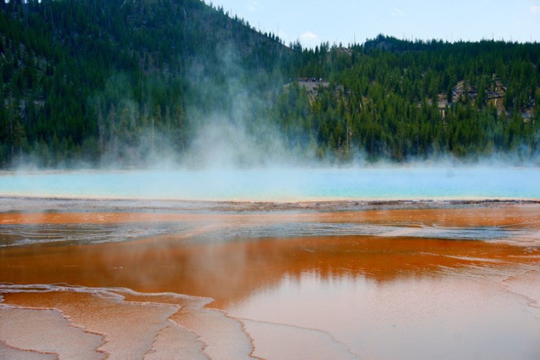
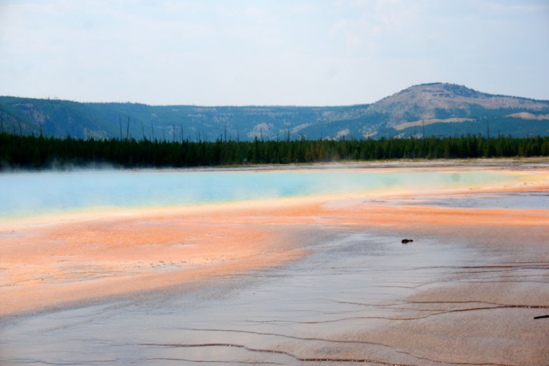
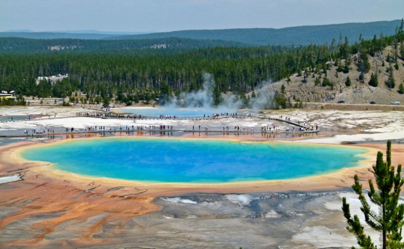
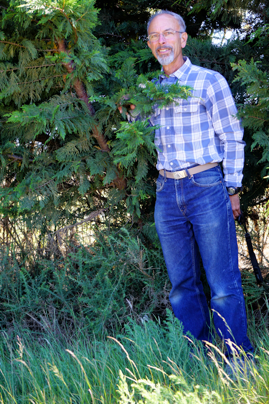
But the prismatic spring is the most spectacular spring of them all. The water is a bright aqua with sulphur colors surrounding it. Ken took a moderately difficult hike up a cliff to get the aerial view, while I shot the views at the spring itself. There are specially adapted microbes that live in these hot temperatures and are aiding scientists to learn about possible life forms on other planetary objects.
YELLOW5YELLOW6YELLOW7YELLOW8

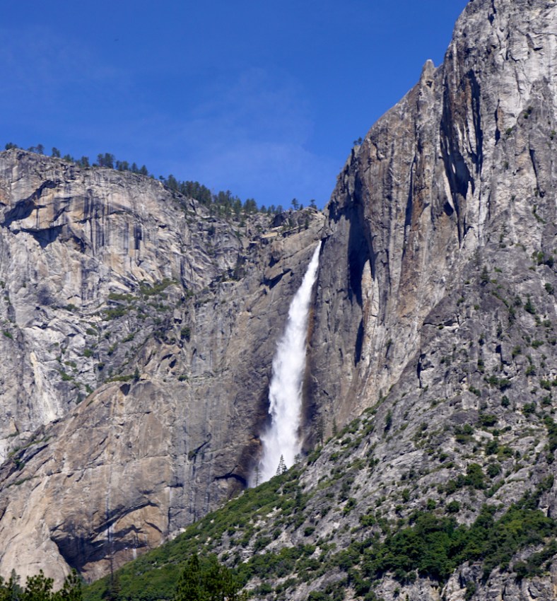
The Yellowstone River has carved quite the canyon through the park. The walls are multi-hued. There’s a beautiful waterfall to photograph (upper falls and lower falls).

YELLOW10

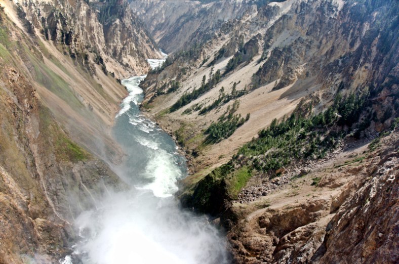
View above the falls looking down

YELLOW9

Close up at the falls

yellow12

DSC02847_edit

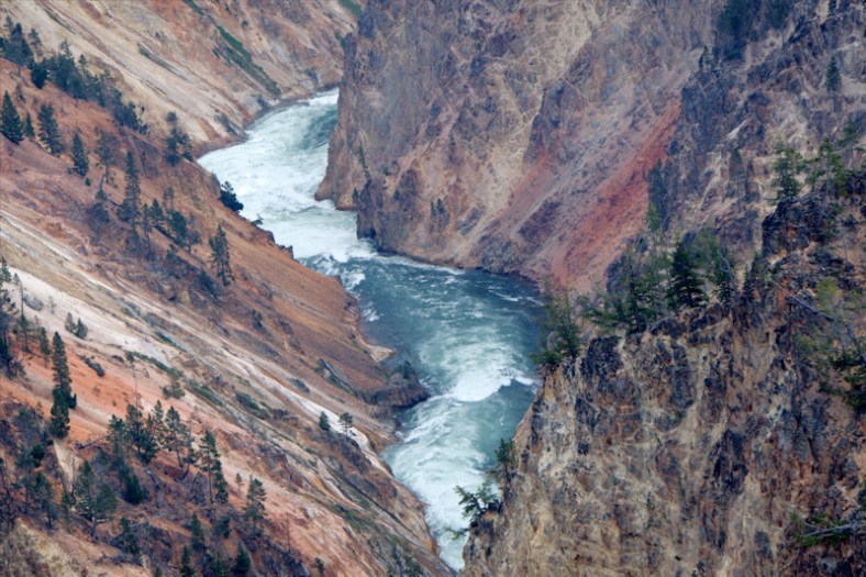
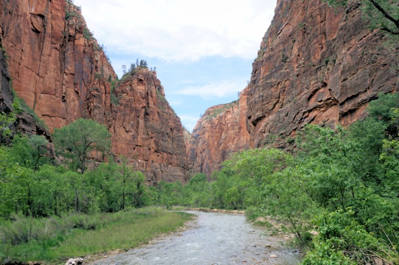
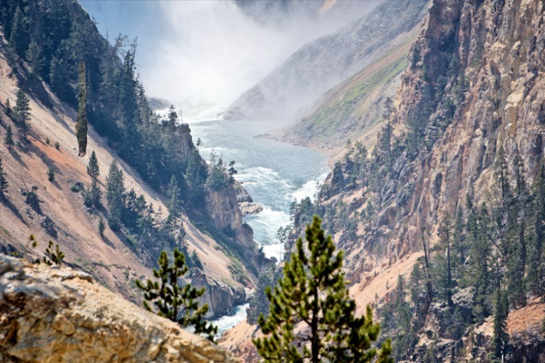
Yellowstone River downstream from the falls
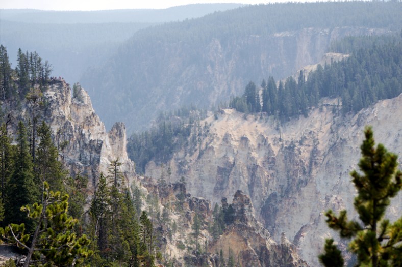
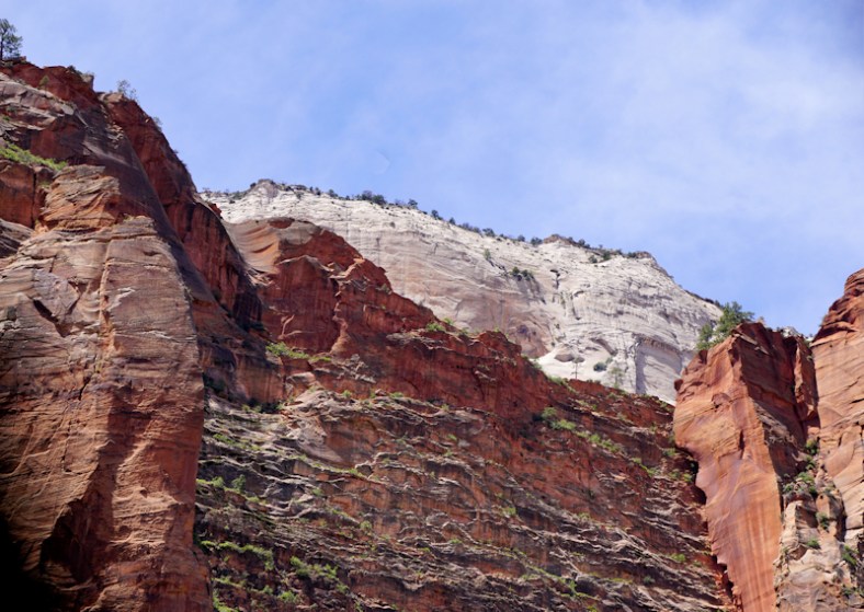
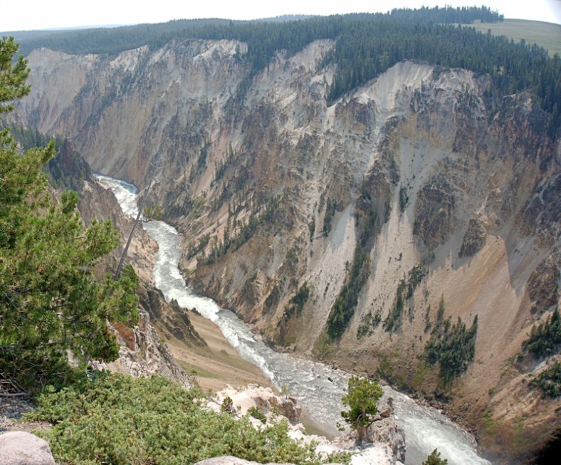
yellow13

Colorful canyon

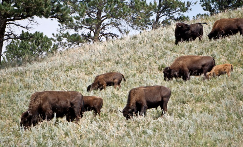
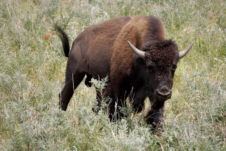
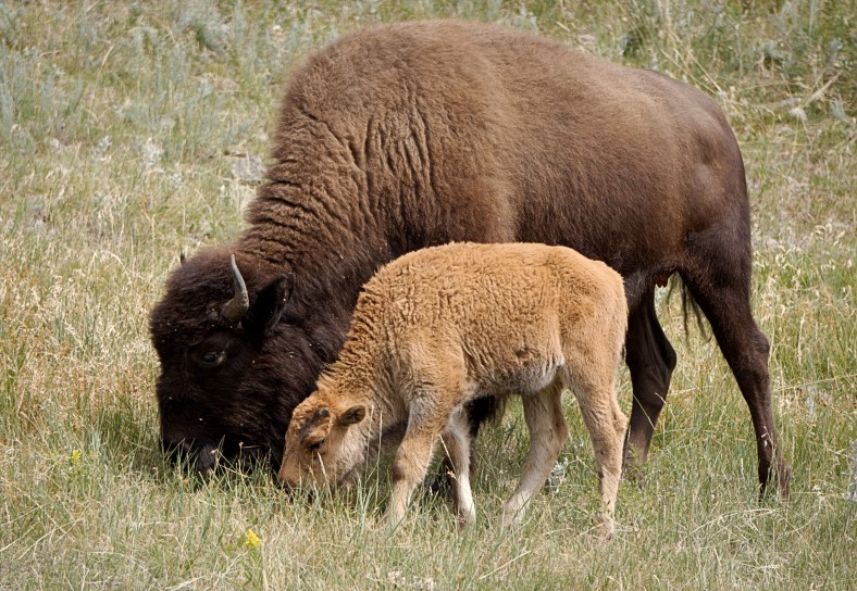
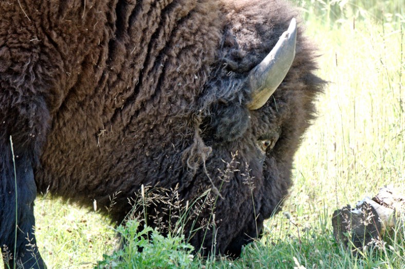
Next, we went looking for all those wild animals that Yellowstone is so famous for. We especially wanted to see the iconic buffalo (bison) herds. Do you think we saw them?
DSC03041_editDSC03061_editDSC03073_edit
DSC03009_edit
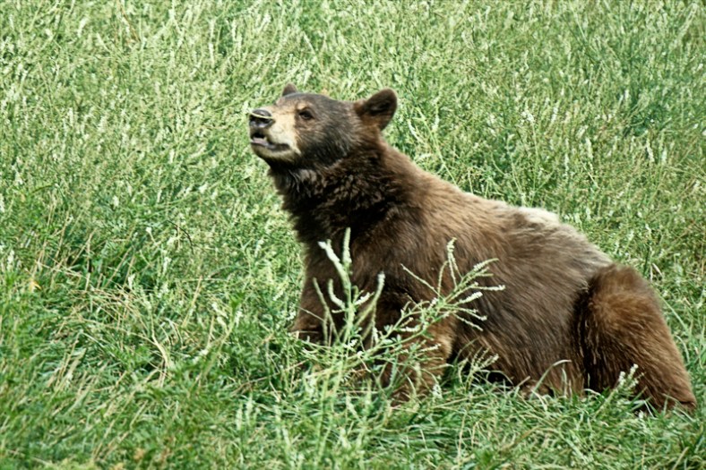
Or what about bears?
DSC02955_edit
Or prong horned antelopes, this hemisphere’s fastest animal?
YELLOW14
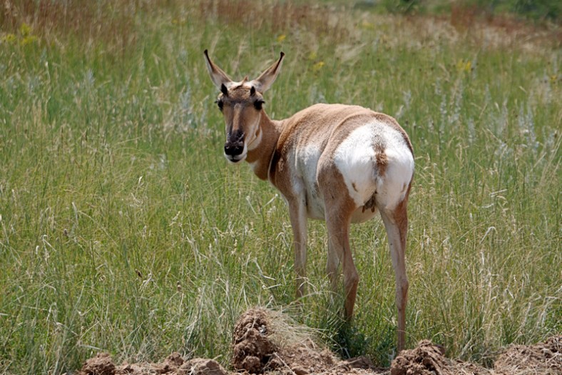
Yup, we saw them. BUT, not at Yellowstone! We’ll save that for another post.

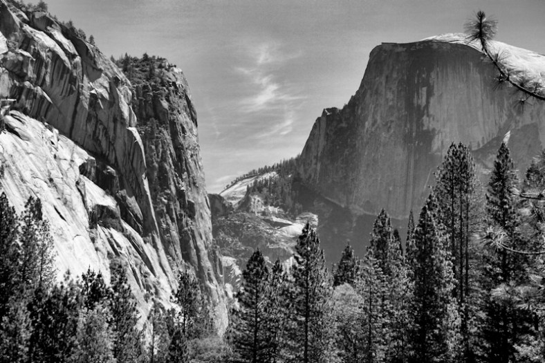
Our stay at Grand Teton was somewhat marred by smokey skies caused by wildfires in Montana and Idaho. Grand Teton is actually in Wyoming. Ken and I did some bicycling there and traveled the scenic routes. It’s interesting how the Snake River runs through these lands, and we had learned how it all ends up in the Columbia River and out to the Pacific at Astoria, OR. The photo below was taken from the very same spot that Ansel Adams took his photo of the Snake River and the Grand Tetons. Of course, I had to deal with the smokey skies!

DSC02895_edit b&wDSC02895_edit

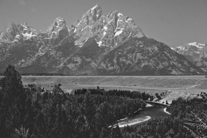
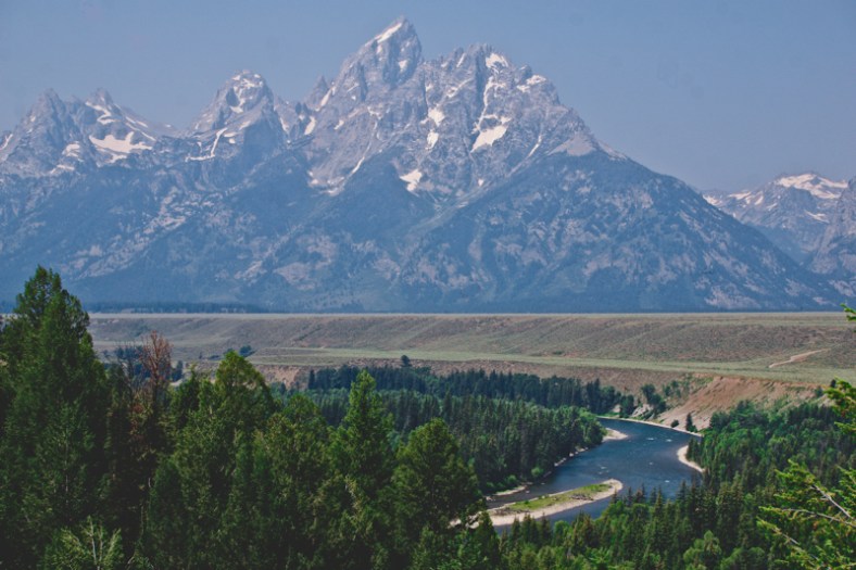
The loop in the river is now obscured by tree growth. If you get a chance to see his photograph, please do because it’s so interesting to compare after so many decades later.

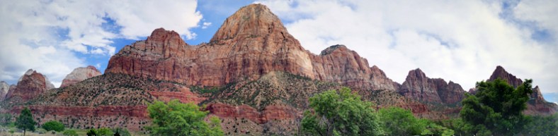
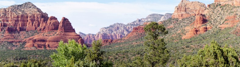
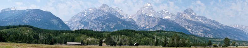
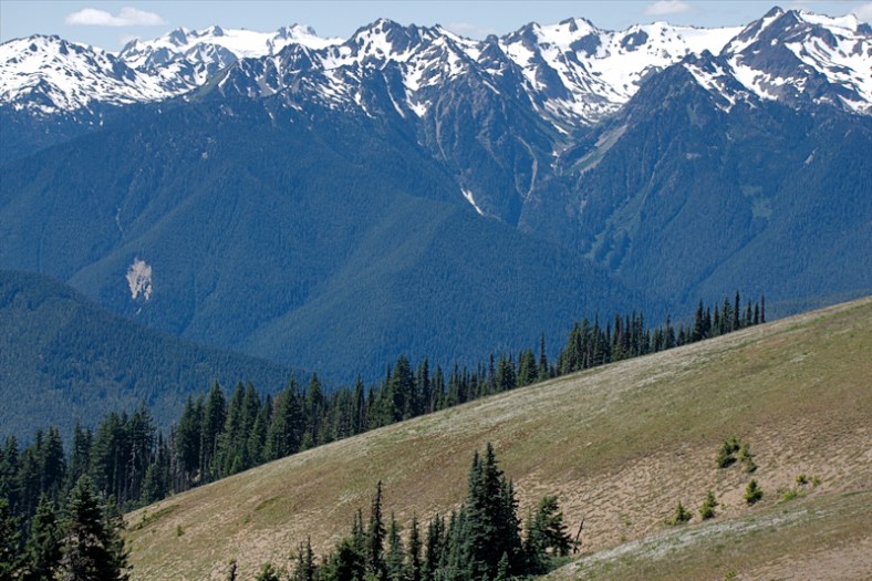
Here’s an interesting panorama of the range:
DSC02918

DSC02914_edit

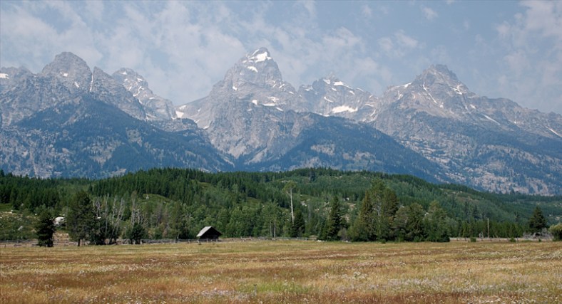
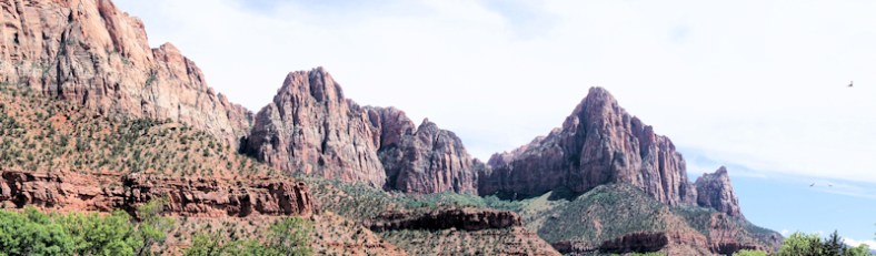
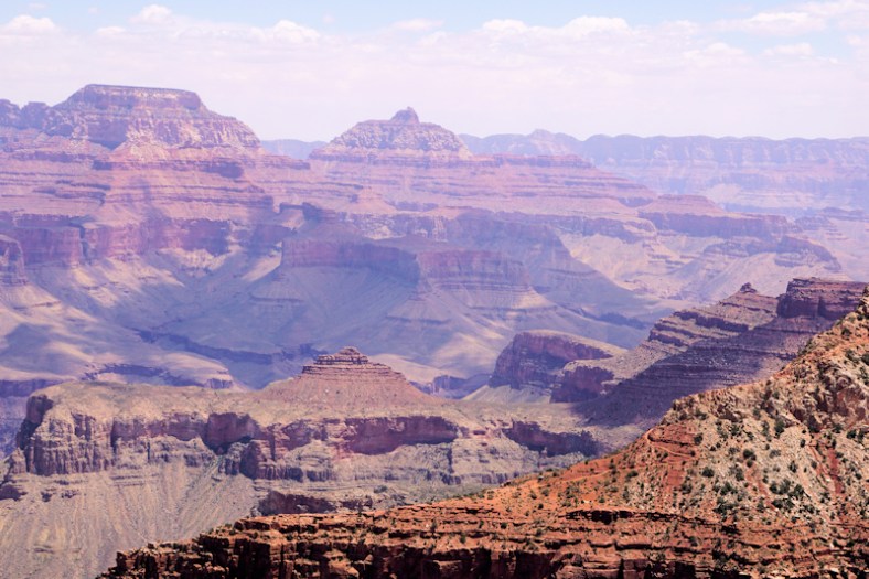
A closer view of part of the panorama above

Yellowstone was the motivation for the concept of a national park. America was the first country to adopt it. History was made here. But, more importantly, this entire area is phenomenally special, and we should all be grateful that we have National Parks! Yes, this country is so gosh darn beautiful!

Volcanoes And Other Beautiful Mountainous National Parks

Our last theme was the gorgeous coast of Oregon. In contrast, we are going to share with you the volcano range of the Cascades in northern California, Oregon and Washington, plus the Olympic peninsula in Washington and Glacier National Park in northern Montana on the border with Canada. We’re saving Yellowstone for its own separate post. Same for Seattle and ditto for Portland and the Columbia Gorge. Yikes, we have a lot of catching up to do!

When we arrived at Mt. Lassen in mid June, we had no idea that snow in the park would render a visit there nearly useless as the bulk of the park was CLOSED to vehicles. The visitor’s center was open, and a short 2 miles past that was as far as you could go! Here is a photo of Ken at the end of the road at the snow bank. Can you see the snowman?

20170619_155147.jpg

That’s a lot of snow that needs to melt!

We did learn a great deal about the entire volcano area of the Cascades that lead all the way up to Mt. St. Helens. These are all classified as active. We planned on visiting Mt. Rainier and driving by Mt. Shasta. These are all the tallest peaks in the U.S. To  make the best of our two full days here, we took a side trip to Burney Falls, which was spectacular! Teddy Roosevelt had high praise for them.
burney.jpg
Our next National Park adventure was to Crater Lake.  But, I want to back up a little bit because we first went to Grants Pass in Oregon to visit with my brother, Richard, whom I haven’t seen in a very long time. On our way to Grants Pass, we drove near Mt. Shasta.
DSC01932.JPG
Crater Lake was also covered with snow! But, most of the roads were open. Hiking was not an option, unless you had snowshoes. I can’t believe that in mid to late June, there’s still snow in these areas! I guess that over 280 inches of snow per year takes a long time to melt in the high elevations. The lake tour boat doesn’t start running until July 4th weekend. Crater Lake is the deepest natural lake in the US at 1,949 feet at its deepest point. It is also part of the cascade volcanic range due to the surrounding mountains. It was formed by a collapsing volcano. There are no rivers or streams that feed into it. It has the bluest water color to it.
crater
DSC01947_edit
In this photo below, you can see some climbers with snow gear tackling the nearby trail!
DSC01976.JPG
DSC01962_edit.jpg

While visiting the area, we did the cascade area “waterfalls” byway trail by car and visited many waterfalls. We’re still hoping to combine our photos and videos to put together a post on waterfalls.

Our next visit was to Mt. Rainier, and you would imagine that by then (July 14th), the snow would be all gone. But, no, there was still snow in places! Of course, the snow is always present on the peaks along with the many glaciers. We would’ve visited Mt. St. Helens since our campground was close to both, but the highway to St. Helens had a washout and was closed to traffic so that was not going to happen. Mt. Rainier’s “Paradise” area is known for its beautiful wildflowers and we caught them just in time. It was so interesting to watch the cloud formations around the peak (elevation is 14,411 ft.). We had a cloudless day, but not at the peak as clouds would come and go just there.

DSC02423_edit.jpg

DSC02454_edit

Mirror Lake

Interestingly, we were able to see the peak of Mt. Rainier appear out of what seems like “nowhere” in Seattle harbor. It’s 90 miles away. Pretty spooky photo!
DSC02610_edit.jpg
The Olympic peninsula in Washington state hosts Olympic National Park. Here we have really tall mountains that meet the Pacific ocean.  Again, they are so high, they remain snow covered.  This park requires quite a bit of driving to see the sights as it’s a huge park with no central location. We should’ve allocated more time to spend here because of this.
olympia1.jpg
olympia.jpg

From the Olympic peninsula we move on to Glacier National Park in upper Montana, straddling the Canadian border. The scenery in the park is splendid, but unfortunately, the infrastructure cannot accommodate the number of visitors that want to spend time visiting here. The roads are windy and narrow in a fairly large section of the park and is pretty much recommended only for their small shuttle buses to use. In other words, no cars for the feint of heart. Ken will not drive! We found that you have to wait 2 to 3 hours to board a bus for the entire road trip, starting from the Visitor’s Center. There’s no parking anywhere else. Then you board the small shuttle for the winding area. This process takes all day! You don’t really have time to get off at the different places for sightseeing and hiking. Most of my photos were taken through the bus or shuttle windows. What a shame! And there’s nothing that can be done to fix this. It is a beautiful place, though.
DSC02678_edit.jpg
glacier.jpg
glacier1.jpg
DSC02687_edit.jpg

It’s neat to see snow covered peaks in the heat of summer. It is also a reminder about how diverse our climate is in this country. And, of course, these mountains are all part of what makes this country so “GOSH DARN BEAUTIFUL”!


The Wild, Rugged and Beautiful Oregon Coast

The entire coast of Oregon is so very special. It is far more dramatic than California in so many ways. Although we didn’t visit the northern coast of California beyond just north of San Fransisco, I can’t imagine it could hold the beauty we found in Oregon’s coast. These beaches are not for swimming, or surfing. They are there for your meditative spirit. They are there to make you say “Ahhh.”

Our first encounter with the coast was in Port Orford, the westernmost port of the United States (before Alaska and Hawaii) and home to the Port Orford Cedar, the wood from which our two boats were made. Just south of the port is Humbug State Park that has mountains and cliffs that meet the ocean.

color port orford humbug.jpg

Looking at Humbug State Park from Highway 101 (Oregon’s Rt.1)

b&w_7.jpg

Close up of the tall mountain that meets the ocean at Humbug

b&w_9.jpg

The turquoise waters of the beach looking north from Humbug Park

The port of Port Orford is very interesting because there are no actual docks for the boats. There are boat lifts and all the fishing fleet are “docked” on either their cradles or trailers once they are back at port. This solves the problem of high tides and strong winds affecting the fleet adversely.
Port
Here is a photo of a fishing boat out in the bay of Port Orford.
DSC02100.jpg
There’s a prominent lighthouse just to the north of Port Orford, warning mariners of the westernmost promintory strewn with rocky out croppings. It’s Cape Blanco, and it’s a beautiful lighthouse that is still important today.
cape blanco.jpg
This is one view of the coast nearby to the lighthouse to give you an idea of why this coast is tricky to navigate. These out croppings appear everywhere!
port orford_3.jpg

After our multi-day stay in Port Orford, we drove north up the coast to a town named Florence, also a seaside destination. We spent our next four days here, including July 4th. We used this as a base to explore other areas of this part of the coast, such as Yachats (listed as a must visit place in all of the guides). Just to the south of Florence are the famous sand dunes of the Oregon Dunes National Recreation Area. In this photo you can see the dunes to the south and the rocky shore to the north.

dunes.jpg

This photo was taken from high above on the route 101 turnoff

A short drive north of Florence was Heceta Head lighthouse. This is one of the most photographed lighthouses in the USA. It also guards a very rocky coastline. It works in the same group as Cape Blanco.
heceta light.jpg

heceta5.jpg

Heceta at a distance

heceta tall.jpg
Here’s some of the coastline to the north of Florence between Heceta Light and Yachats.
florence.jpg

yachats.jpg

Near Yachats

yachats beach.jpg

Yachats beach

yachats beach2.jpg

Family time at the beach in Yachats

From Florence, our final destination in coastal Oregon was to Seaside as our base in order to visit Astoria to the north and Cannon Beach to the south. Both of these locations are on everyone’s “must see” list in Oregon. They are much different places.

Cannon Beach is absolutely gorgeous. The coastline is beautiful with large outcroppings that seem to be placed in just the right places for a picture perfect photograph. The shops in town all resemble shops that might be in Nantucket, either in weathered gray wood boards or light tan ones.

In one of the shops, I even found a ceramic coaster that had a drawing of a schooner that looked just like Woodwind. I bought two of them to send to Jen.

Standing in the Ecola State Park in Cannon Beach, I photographed these rugged coast photos:
cannon park.jpg

cannon b&w.jpg

A color original made into a B&W

The “haystack” outcrop in the distance in both the photos above appear below at beach level. Compare it to Morro Rock in California!
cannon beach2

cannon beach
Is it bigger than Morro rock???

Our next “port of call” was Astoria, where the mighty Columbia River meets the Pacific! We only had one day to spend here and decided that the much praised Maritime Museum would be a must see. It did not disappoint! We learned so much about all the shipwrecks on those moving sandbars at the mouth of the river. This area is the most dangerous in the entire U.S. due to the strong currents that cause the shifting sand. The museum was dedicated to showing how all the pieces fit together to perform warnings to mariners, and life saving when those warnings no longer work. It covered early recovery boats, the original Columbia Lightship, early weather forecasting through to modern day methods and modern electronic aids in search and rescue.

We ate lunch at a very different place: A Bosnian restaurant named Drina Daisy. Ken had a stuffed cabbage dish (not your typical tomato based type) and I had a goulash. As you can see, they were both presented well and were also very tasty!

We also learned how the city had to move itself up the hill from the river. There are still underground tunnels connecting to the old river level.

From here, we travel east to Portland and to the Columbia Gorge. That will be another blog post.

Marina in Monterey Bay, CA

We made plans to stay here for 5 days to give us time to see the area and to get some small projects done on our prairie schooner. It is remote enough to feel like camping and yet convenient to restaurants, shopping and sightseeing with it only being a 25 minute drive to Monterey including its always-present traffic. This area is also well-known for its damp maritime layer which influences its daily weather. Our campground, Marina Dunes, is on a small side street directly across from the Monterey Dunes Preserve in Marina. These huge dunes can be seen from Monterey when there’s a clear sky. We had a dedicated walkway directly from our campground. The campground is listed as one of the best for waterfront views/access in California.

We spent a couple of days in Monterey. One of our favorite places from year’s past is the world-famous Aquarium. It’s always fun to return there again. The sea otter feeding “show” gives us a chance to see these cuties act up.

The gigantic tanks of reef fish where walls of glass surround you with their habitat is gorgeous.


And, the display of jellyfish was so mesmerizing, I had to set their movements to music. But first, here are a few stills:

Here’s the link to the YouTube video: YouTube Video Monterey Aquarium

A visit to Monterey would not be complete without strolling the touristy areas of Fishermans Wharf and Cannery Row. Of course, we did both! One of the advantages (or disadvantages) of traveling in small quarters is that you can’t load up with gifts and souvenirs for yourself, other than jewelry: no place to store them safely until you get home. A picture essay is shown below after the two panoramas:

20170609_145310

Cannery Row

20170609_114647

Fisherman’s Wharf

This slideshow requires JavaScript.

The weather here is cool, in the mid 60’s during the warmest part of the day but it takes time for the blue skies to appear. We were lucky that on these two days of photos, we had good days for photography. As for the the inclusion of the Trump items in the slide show, well, we found them in a shop here at Cannery Row. This is California.

Port Orford, Oregon: Mission to Find Port Orford Cedar Trees

Both of our Woodwind boat’s hulls are planked with Port Orford Cedar. John Scarano, our designer/builder, loves working with this unusual wood because its grain is tight and straight, it is light in weight, it is rot resistant and insects don’t like its aromatic oils. Over the years a fungus has been affecting the roots of these majestic evergreens and they are dying off before scientists can figure out a cure. They only grow in a small area of the world in near coastal northern California and southern Oregon. Port Orford, OR is where they were first identified by a botanist named Lawson visiting from England.

This wood has created a high demand because of its scarcity and because the orient values it so highly for religious uses and its great inherent qualities above. Our boat builder had to actually buy the wood from the Japanese who purchased the wood from the same wood broker. It is quite expensive for a conifer.

port orford twig

Port Orford twig

We both decided that once we knew we would be visiting Oregon, we would have to find Port Orford trees. So, a coastal trip up the coast was planned. Once we arrived, careful research didn’t help much to find where we might see these trees. Ken just wanted to hug one! Folks didn’t really seem to know where they are.

We went to Humbug State Park and a ranger there named Paul showed us a small tree there. He cut off a sprig, which we used as our guide to find more trees, hopefully large ones within a grove or stand, which would be large enough to make boards from. After spending parts of two days searching , we found some small trees lining a roadside.

P1040368

Front trees are all Port Orford Cedars


port orford tree

Small Port Orford tree and Ken

We put together this as a quick post to be timely. But, wait until you see a later post as to how “gosh darn beautiful” this seaside place is! Here’s a teaser:
color port orford humbug

Sequoia, Kings Canyon and Yosemite National Parks

This Country Is So Gosh Darn Beautiful, Part II

A visit to these three California national parks, all located high in the Sierra Nevadas, is a visit to some of the most beautiful places on earth. Each one has its own charm and will be discussed separately. Each one is deserving of this sub-title.

Sequoia

While we were here, it was freaking cold out! Like in the upper 30’s and no sun. The reason for this is because of the extreme elevation of the area (5,000 to 7,000 ft.) and also the weather pattern at the time. But, we were actually high up IN THE CLOUDS themselves! We can see the temperature change 30 degrees as we traveled through the switchbacks up to the Visitor’s Center and beyond. Visibility was near zero at times so driving and sightseeing was hard. Forget about an outdoor picnic! We had to abandon all of our plans and eat concession food indoors and limit our time outdoors due to the cold, damp weather. Brrrr. You needed winter clothes and mittens/gloves!

IMG_20170611_164615

Note the cloud fog caused by being in a cloud. Size compared to fence and bus behind.

The park has the largest sequoia trees in the world. They only grow in this narrow range of elevation. They live to more than 3,000 years old. Their wood is NOT useful for anything. They can easily survive fires.
P1030954
sequoia
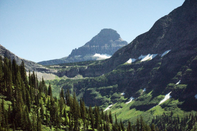
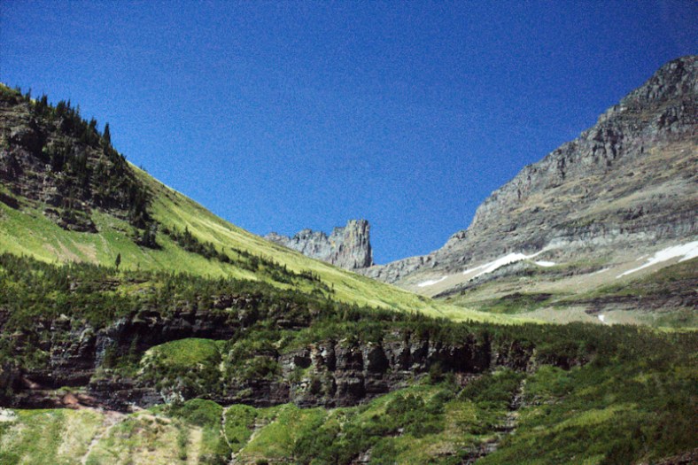
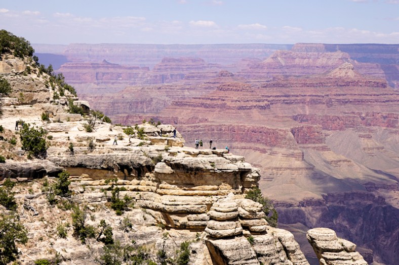
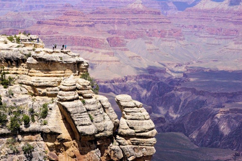
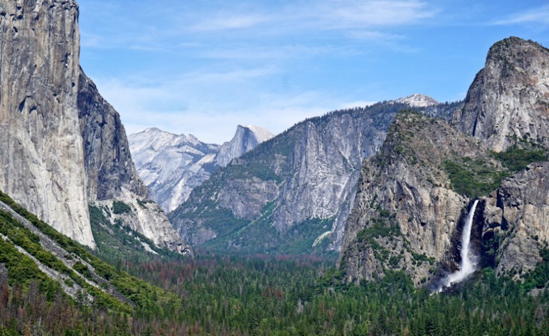
I wish we could have enjoyed the outdoors more while high up in the park. Hiking and biking were definitely not on our agenda for the day we had to spend here.

Kings Canyon

Again, this is so dependent on elevation for your comfort factor. But, our plan was to do the 20 plus mile gorgeous drive through the the canyon to the end (eastward) and back, which would be a good part of the day. We would also spend some time at Gen. Grant’s Sequoia tree, which is over 2,000 years old. It’s not quite as high in elevation here nor as cold and into the clouds. By the way, while we are experiencing some cold weather in these parts, word is that Yosemite is experiencing some SNOW!

Here’s the General Grant Sequoia tree:


Here’s a hollowed out tree as a tunnel:
DSC01746
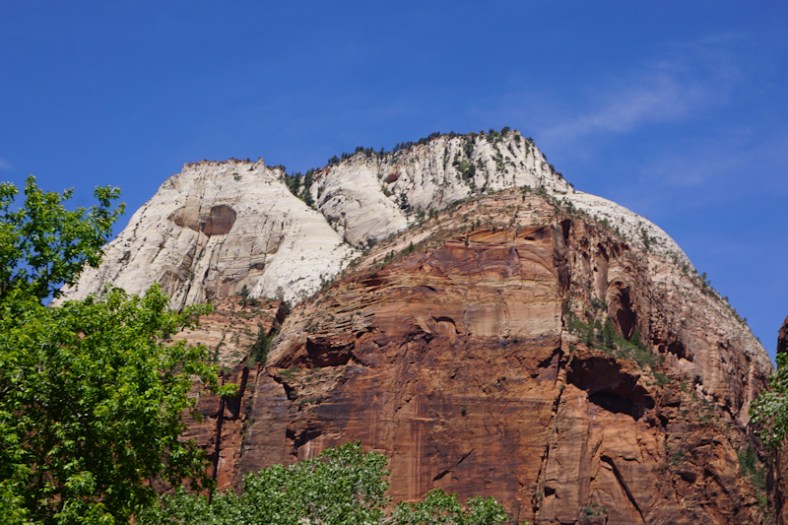
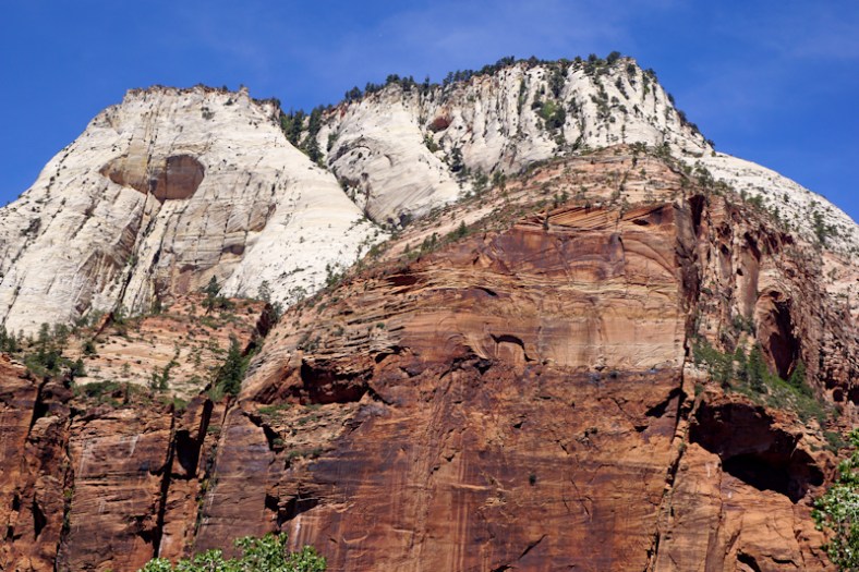
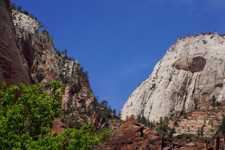
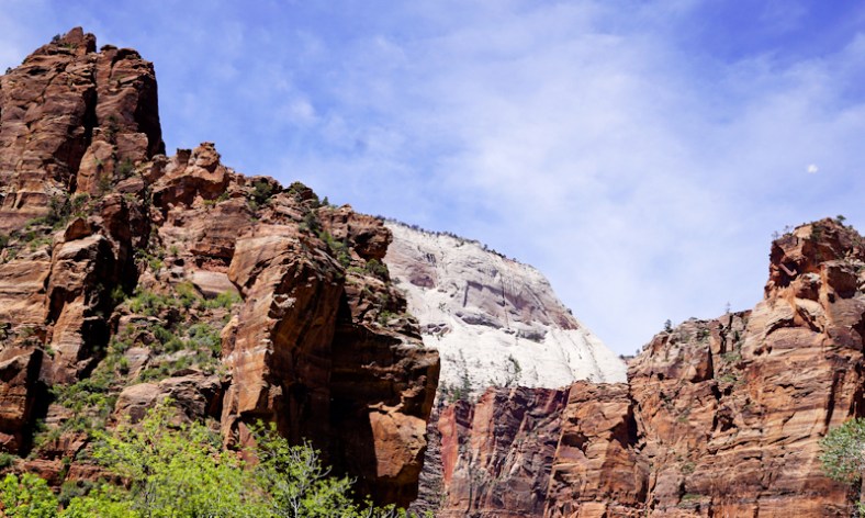
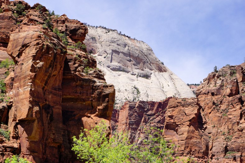
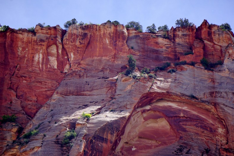
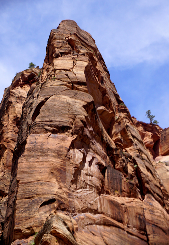
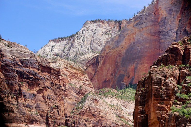
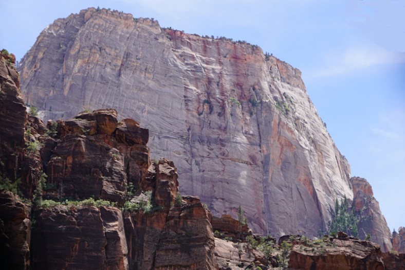
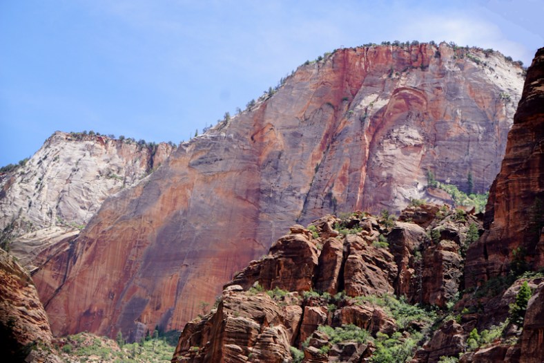
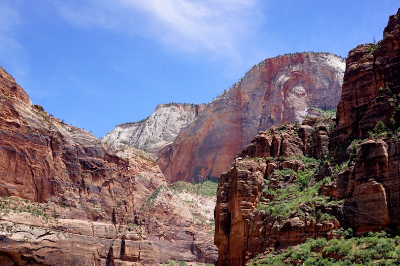
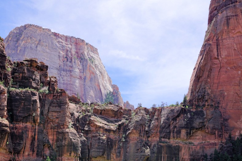
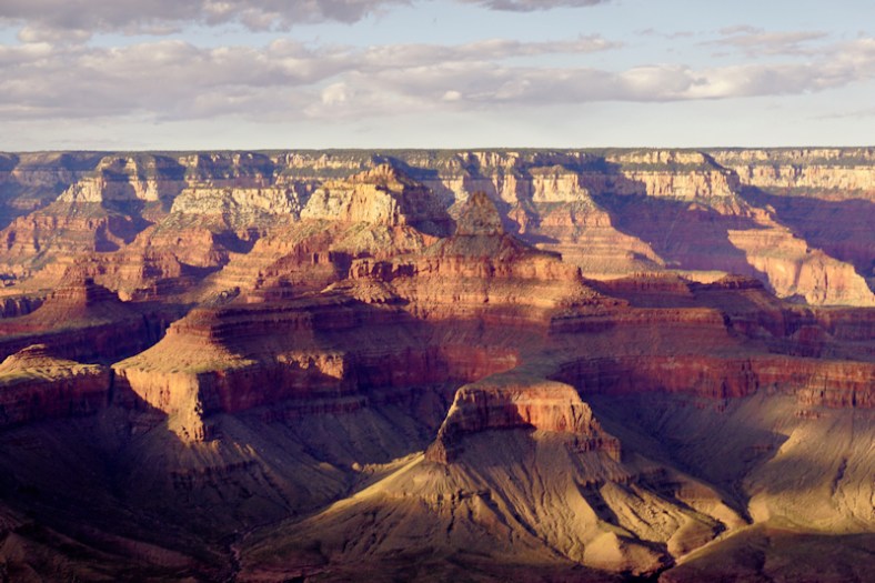
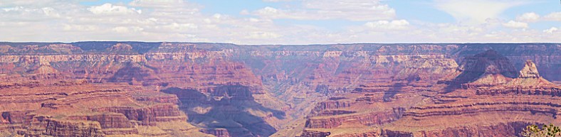
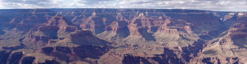
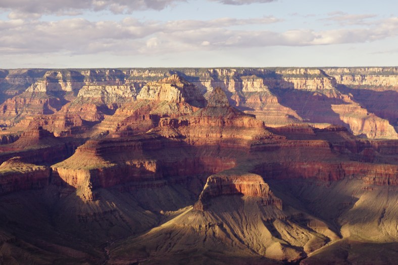
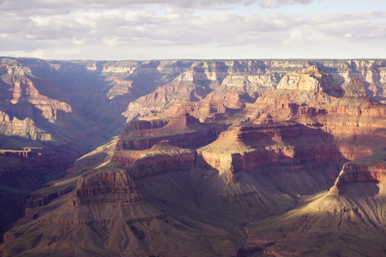
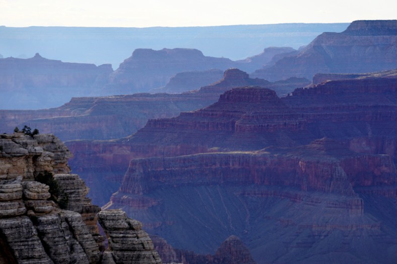
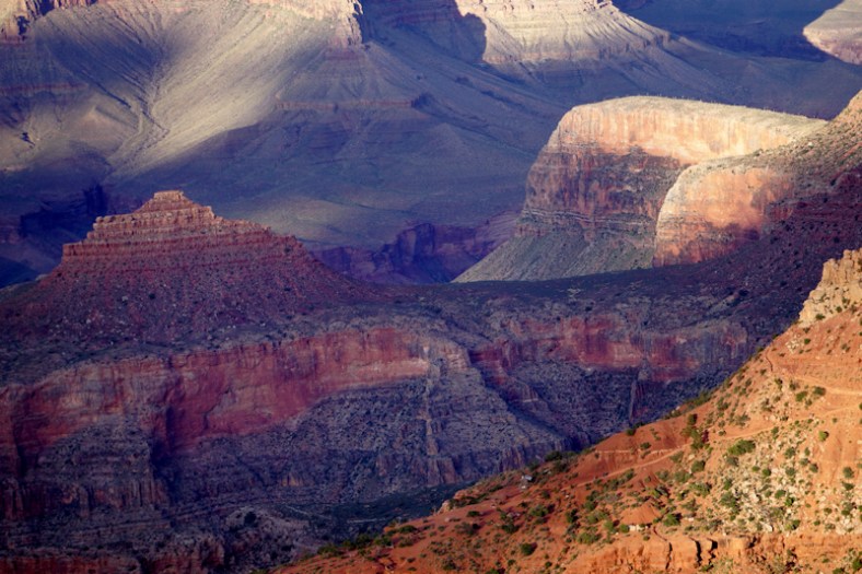
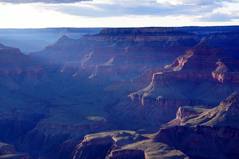
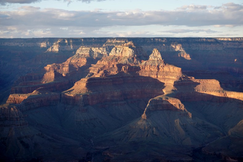
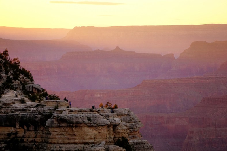
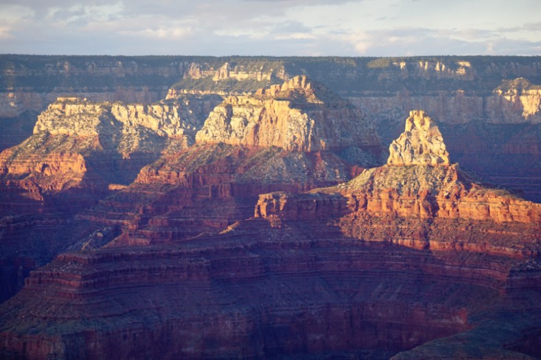
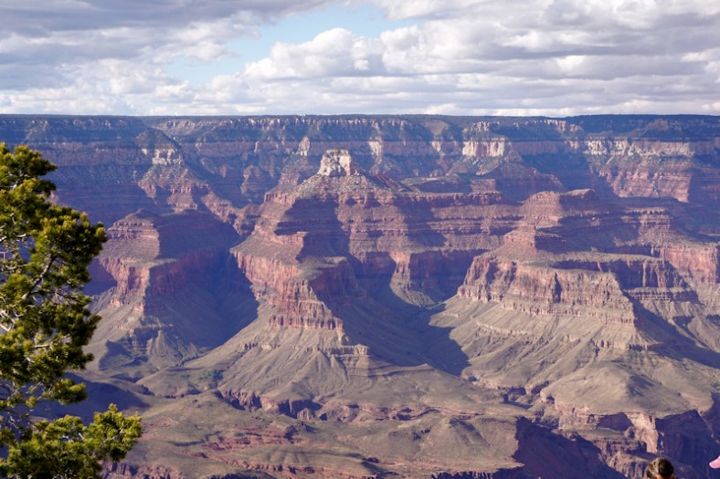
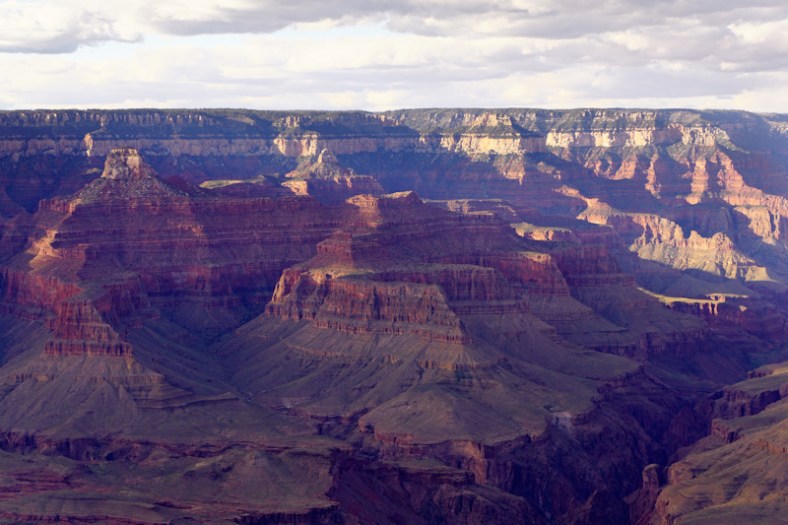
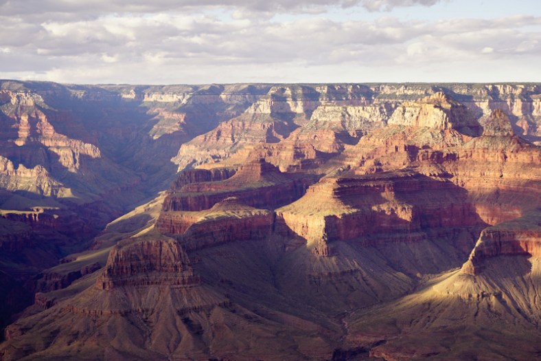
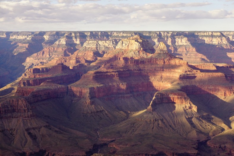
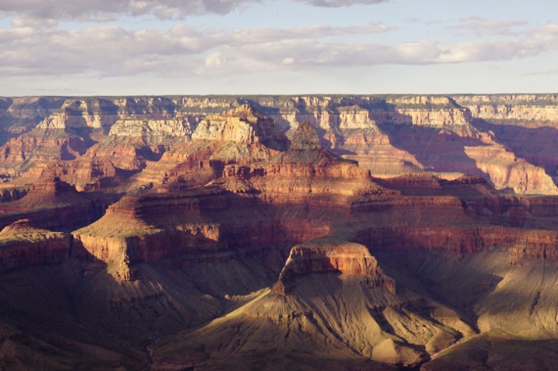
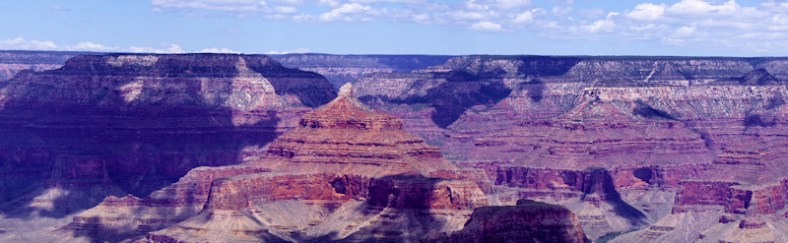
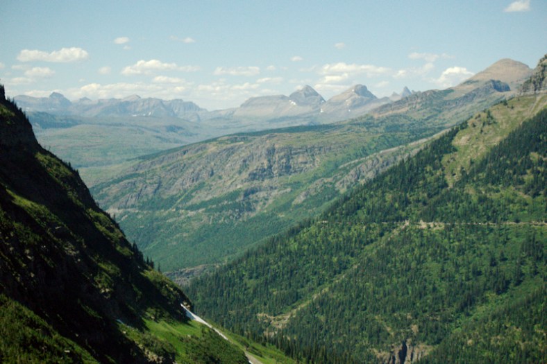
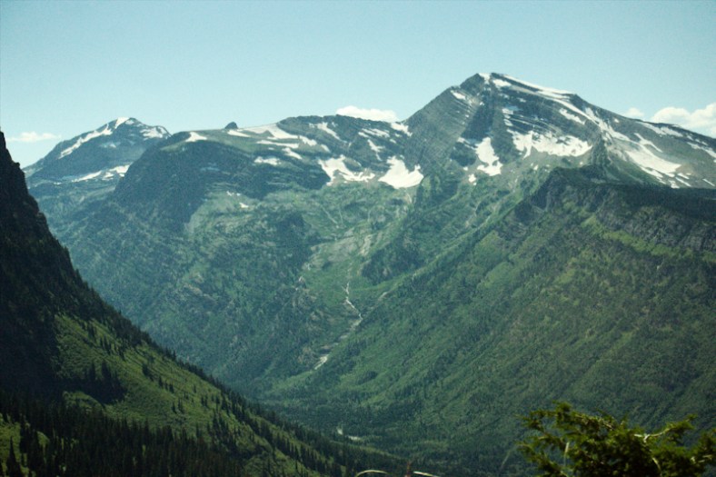
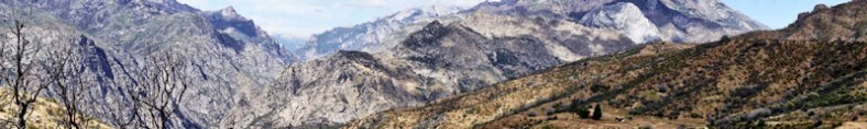
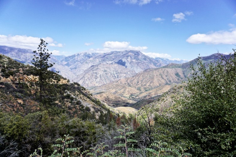
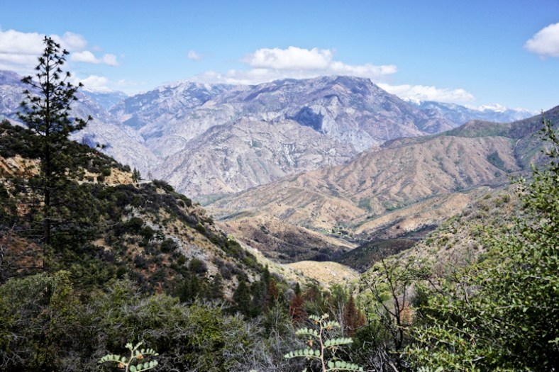
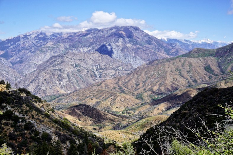
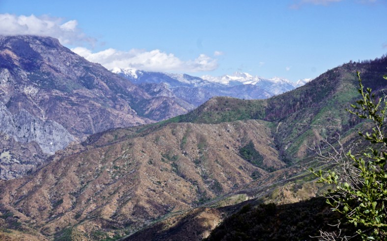
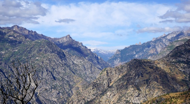
Our drive through the Canyon was absolutely spectacular. It was on my birthday and was the best birthday present. Ken drove east, while I did the drive back to our motorhome. Here’s my photo essay after these two panoramas:
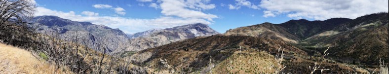
kings7
kings6

kingskings1kings3kings4

kings5

DSC01794

We captured many waterfalls, and will be its own subject post next!

Yosemite

By the time we got to Yosemite, the weather improved and became quite pleasant in the higher elevations. What was rather shocking to us, though, was the travel time from our campground to the main Visitor’s Center in the Yosemite Valley: a whopping 2 hours with normal traffic! It was about 20 minutes longer due to road repairs. Had we booked at another campground on another route into the park, we would’ve been in much worse shape because a rock slide closed that route’s entry in and added an additional 45 minutes travel time for that route. The only campgrounds with decent commutes are the inner park campgrounds without services. We stayed in the small town of Coarsegold. Close by was the larger town of Oakhurst with access to shopping and services, at 8 miles away. It was here that I was able to get a decent haircut at a decent price.

As mentioned above, we’re saving everything having to do with waterfalls for our next post. The following photos will show off Yosemite minus the waterfall features it’s so famous for (except for one). We took the most beautiful bike ride ever at Yosemite. They have wonderful walking/biking paths.

yoz

Yosemite Valley. Post tunnel viewpoint with el Capitan, Half Dome and Bridal Veil falls

yoz1

Half dome on right. Taken during our bike ride.

yoz3

Different view of scene above

DSC01855

yoz4

A little bit of Ansel Adams’ inspiration!

Our dear friend, Susan Helbert, said we’d love Yosemite and she was absolutely right. We also met up with Deanna and Brad while we were there. Deanna worked for us for many years. They were visiting from Hawaii.

So, our next post will cover everything waterfalls. After that, we head to Lassen Volcanic Park and on to Oregon!


Deserts, Dams, Mountains, and the Pacific Ocean

Over the time span of a few days, we spent time in many different terrains! After Zion, we camped in the desert of Willow Beach, part of the Lake Mead National Recreation Area. It is a recreation area because the man-made lake was created by the Hoover Dam so that electricity can be generated by the dam while controlling the flow of the Colorado River. Our campground was on the River.

mead

View from the hill of our campground of the Colorado River

We were here the week before Memorial Day weekend and it was already very hot, close to 100 degrees! There were no shade trees at our campsite.

While there, we toured the Hoover Dam. It is enormous in scope. I remember reading about it in history books as a student. I didn’t realize then how important it was for its electric power generation.

P1030606

Hoover Dam at the Colorado River upstream side

DSC01548

Generating Electricity in the Power Plant Within Hoover Dam

P1030623

Statue of Dam Worker

P1030603
The photo above gives you a sense of scale of size for the dam. The river is below out of sight of the photo.

The recreation area created by Hoover Dam: Lake Mead and Lake Mojave are beautiful blue gems arising from the barren desert that surrounds it.

mead2

Lake Mojave Panorama

mead3

Lake Mead Panorama

Next we traveled to the Angeles mountains of California to a small Canyon town of Acton. We stayed at the Californian RV Resort over the extended Memorial Day weekend. We were on the dry side of the mountains, so we were seeing desert-like landscapes but mountainous in terrain. On the long trip here from Lake Mead area, we passed by Las Vegas and the entire stretch of the Mojave desert. We saw several large solar farms in the desert that date back several decades. This scenery is so totally strange to see. While in this area, we stopped at a farm animal sanctuary and learned about big business farming. I almost became a vegan on the spot, but I don’t like soy products, so I “chickened” out.

DSC01584

Ken hugging one of the rescued cows

Here’s another relevant photo op of Ken while at the Sanctuary:
20170528_124637

From the mountains, we headed west to our destination of Oceana/Pismo on the Pacific. Our first sighting of the Pacific was while driving in Ventura. We visited Pismo Beach on a really windy day and Ken got some great shots of someone kiteboarding.

brian

After our stay in the Oceana/Pismo area, we moved north up the coast to Morro Bay, where we stayed in a campground very close to the famous iconic rock (rock is right behind). It was also a short walk/bike ride into town and the waterfront from here.

20170602_122549

Photo taken from our campground. Bridge to Main street on waterfront

morro

Panorama from atop of mountain at Morro Bay State Park

Note the hazy fog in the photo above. That is often the case around here. Also, this is a natural harbor as the land forms an isthmus to the rock.
morro1

morro2

Note the black schooner in the center

In town, Giovanni’s fish market had great smoked fish. There were lines on a weekday at 4PM to get seated at a table. We bought smoked yellowfin tuna and calamari salad to go.
20170603_161728
Since Jen is a wine club member of Cass Winery in Paso Robles (nearby wine country), she got us comp tickets for a members only dinner under the stars for June 2nd. It included 2 glasses of wine and star gazing with telescopes from students at Cal Tech. It was a fun event.

Morro Dunes was also our base for visiting Moonstone Beach to the north in Cambria and San Simeon for the Hearst Castle. At the castle, we had guided tours each which lasted a little over an hour in total time. Here’s a slideshow of the castle:

This slideshow requires JavaScript.

When at Cambria, we enjoyed our walk on Moonstone Beach, named for the type of stones which can be found there.
20170604_133715
While in the cute town of Cambria, we ate at Linns, famous for their pies.

Next post will cover Marina in the Monterey Bay area.


Zion Canyon Is About Looking Upwards

This entire area is phenomenally gorgeous. It’s one beautiful vista after another. Imagine the red rocks of Sedona, Arizona on super steroids. The entire length of the canyon/park is special. Springdale, Utah is the town surrounding the park’s entrance. The Virgin River runs through the park. Our campground, Zion River Resort, was located in Virgin and the river runs through the back of the property.

zion2

Virgin River surrounded by high sided red walls!

The drama of the Grand Canyon was about the vastness looking outward and down. The drama at Zion is about the vastness looking outward and up. All of the major points of interest in the park had been given biblical-inspired names by the Mormons who settled in the area, including the river’s name (wink, wink). It’s easy to interact with your surroundings here with many suggested hikes from easy to difficult. Some are even handicap accessible. During the main tourism season, the scenic canyon drive is closed to vehicular traffic and shuttle buses provide the mode of travel from vantage points to hiking trails and visitor’s services. I shot so many photos, I want to share them all. Ken also went on a more strenuous hike than what I could do so he will share his separately.

zion3

Panorama to get things started

zion34

Another one!

zion18zion19

zion20

Close up of the photo above this one. Those are pine trees on top!

zion21

Same series to the left

zion24

zion25

Close up of the photo above this one

zion26zion27zion28
zion29zion30zion31zion32zion33

Are you getting the feeling that this place is paradise? Well, here are more photos to help convince you if you haven’t made up your mind yet:

zion12zion13zion14zion15zion16

zion17

Virgin River on the right

zion18zion22zion23


Ken’s Hike

“I  decided to take one of the hikes labeled as the Watch Tower. The following view is from the top. The difficulty was listed as medium. The path is very clearly marked and it was a perfect challenge for me. It was steep enough to give me a sense of accomplishment without exhausting me. The drop offs are steep and a misstep could be fatal, although the path is wide enough that it should not be a problem. Building this trail must have been difficult. Erosion of the trail by the occasional violent storms was part of the planning. Along the path stones are placed diagonally across to the path and angled downward to channel rain water to careen down the cliff rather than down the trail.
zion35

Note how the rocks on the trail form a shelter almost resembling a prehistoric bus stop.

trail2 sm

Notice the subtle changes in color of the various strata

Zion is a study of erosion. Most of the rock is jagged, but some are smooth, caused by moving water. This gives the rock the look of melted plastic or exotic pottery.

And then there is the contrast between the comical commercial aspect of the area and the almost ethereal beauty. This is outside the park. Much praise to the National Park Service for their care, maintenance and passion for educating the public of the beauty of this area.”

sublime redicu sm

From the sublime to the ridiculous!


Each day at the park, we were able to park our car in town and grab the shuttle to the Park’s Visitor Center. Ken enjoyed some brews (a flight) at the local brewery in Springdale. I found a beautiful necklace and earring set for Jen’s birthday at an artist’s gallery in town, made from cyan blue butterfly wings (Costa Rican butterflies).

jen butterfly jewelry

Our only regret is that we hadn’t pushed further to the east to get to see Bryce Canyon. But, it would be a two and a half hour drive away (each way); too far for a day trip.

The drive up to Zion from Williams was interesting passing through multi-colored desert scenery and miniature red rock canyons. We had two scenic/tourist stops, one in Cameron, AZ, home of the Cameron Trading Post, and the other at the Navajo Bridge over the Colorado River. The Navajo Bridge experience was a crazy one. We pulled into the driveway towards the parking area for the visit only to find out that there is no place to park our rig and tow! We had to disconnect the car, move both vehicles, parallel park, and re-hook up before leaving. This is a first! We had always worried about this happening. It’s kind of like worrying about a knockdown on your boat and once when you experience it, it’s like, okay, no big deal.

And Cameron is a small town wrapped around the Trading Post:

From Zion we head to the Lake Mead area and then on to California and the Pacific mid-coast. More posts to follow of course!

Our Grand Canyon Dream Come True

Ever since I was a child (Ken, too), I dreamed of seeing the Grand Canyon. Perhaps it was the Grand Canyon Suite or the many pictures and movies that I’ve seen of it, or stories I’ve read about how it makes you feel. After all, it is one of the “seven wonders of the world”. It has been on the top of my bucket list for as long as I can remember. All I can say now is that after seeing it live, it did not disappoint!

We wanted to stay in a full service campground, which meant staying in the cute western town of Williams on Route 66 (where you can get your gitch) at the Grand Canyon Railway RV Resort and Hotel. It’s a total of a one hour drive to the Grand Canyon Visitor’s Center. We were fortunate to be here just before the busy season begins so we didn’t have to fight crowds, but we did have to deal with some pretty cold weather, especially after the desert heat which we became accustomed to. It’s all about elevation and Williams is just about the same elevation as the Grand Canyon at about 7,000 ft. We had two nights well below freezing and one night with snow accumulation! But, the day warmed up nicely with only light jackets needed.
Here’s a slide show of downtown Williams:

This slideshow requires JavaScript.

We spent two full days at the Canyon. The first day was spent learning everything we could, and we were there quite a long time. The second day was planned to arrive there later in the day so we can get sunset photos. Both times, parking in the park was easy. Ken took the Ooh Aah Point hike (the easiest) down and back up.

gc29

View from Ooh Aah Point

Both days we brought a picnic lunch or dinner. We also used the free shuttles extensively while leaving our car parked at the Visitor Center near the Shuttle Hub. While Ken was hiking, I explored the stops on the shuttle bus.

The photos below were taken during normal daytime.

gc14

A panorama view that tries to capture the great vastness of the canyon

gc17

The foreground rocky cliffs give a sense of depth to the canyon

gc20

A sense of “grand” when seeing the scale of people on the rocks

gc7

Another view of the people on the rock outcropping

A slide show from various viewing points on our first day:

This slideshow requires JavaScript.

A photo showing the Colorado River 5,000 ft. below:
gc3

Ken enjoying the park!

Sunset Photos

Returning the next day so we could capture the sun setting in the canyon, I captured many photos which were all taken at Mather Point. This is considered the best place for the sunset photos. I was surprised at how uncrowded it was. I’m hoping you will notice many of the photos below are of the same angle and subject as some of those above and you will be able to enjoy how different the light makes them appear. It’s magical and spellbinding.

grandcanyon13

Panorama where sunset creates depth by shadows

grand-canyon1

grandcanyon2

grandcanyon3

Compare this to the people photo in the series above

grandcanyon4grandcanyon5grandcanyon6

grandcanyon7

Compare this to the other “people” photos above

grandcanyon9grandcanyon10

grandcanyon16grandcanyon17grandcanyon18grandcanyon1

I hope that these photos helped to make you feel a little bit as “high” as I felt when looking at this wondrous place. America is so gosh darn beautiful! This is just one place among many that we have and will visit in the weeks and months ahead.

This Country Is So Gosh Darn Beautiful!

I could almost cry tears of happiness!

When I was a child and my parents took me to New London, CT to the shore, I remember my Mom saying that from here onward is a very big ocean for thousands of miles away. My answer was “Oh, it’s too big for my eyeballs”. And for me, ever since, anything that was awe inspiring would illicit that same child-like answer. Well, this post is about the incredible beauty that we’ve seen in three distinct places here in the southwest: The Painted Desert/Petrified Forest, Sedona and the Grand Canyon. They’re all “too big for my eyeballs”! Actually, I’m going to only give a small hint of what is to follow for the Grand Canyon in our next post.

The Painted Desert and Petrified Forest National Park

I’d also like to start the section on the Painted Desert with a question. How many of you listened to the Grand Canyon Suite by Fernand Grofe when taking music class? One of the movements was the Painted Desert. We downloaded the piece so we could listen to it while we looked at our just-shot photos in a slide show. It was incredible. However, none of the photos could do justice to the actual feeling of being present there. This is a park that you drive through for 26 miles. It begins with the Painted Desert and ends in the Petrified Forest.

petrified7

Panorama of Painted Desert

petrified3petrified4petrified5
petrified6
Hopefully, you’ll get some idea of why this area is called “Painted” Desert.

Next on our trip through the 26 mile leg, we came upon the “tepees”:
petrified2
petrified1

Next we found an ancient stone with petroglyphs:
petrified17
We found a petrified log that formed a bridge over water:
petrified18
Lastly, we came to the petrified logs strewn about in the desert:

petrified16

petrified15

Close up of interior deposits

petrified8

Crystal deposits in a log

When we were in Las Cruces, we visited the Zuhl Museum at New Mexico State University, where they exhibited the petrified logs in their polished forms. Here are the ones from the Petrified Forest:

petrified9
petrified10
petrified11
What a fascinating and beautiful place this is. We were surprised at how few people were visiting here the day we passed through.

Sedona, a Magical Place

Our plans were to meet up with Ken’s cousin Danny and his wife Beth for Mother’s Day weekend (May 12-15) in Sedona. They live in Phoenix. Although Sedona is not a National Park, its scenery rivals that of many parks. But, first I’m going to discuss the family happenings.

Danny and Beth met us at our campground, Distant Drums (actually in Camp Verde, a 30 minute drive from Sedona) on Friday around 5PM. From there we drove our cars to Sedona so that they could check in to their Inn, and we could go out together for dinner at Elote, an upscale Mexican inspired restaurant owned by a James Beard finalist chef, Jeff Smedstad. There was an hour wait, but it was worth it!

sedona20

My dish was corn encrusted scallops

Here’s Beth and Dan enjoying their dinner:

sedona19
There’s a cookbook available by the Chef.

sedona21

The next day’s dinner was at L’Auberge, outdoors by the creek (Oak Creek). This is a Price Fixed Dinner of 3 courses. The meal was incredible. Our waiter was extremely knowledgeable, and Ken ate rabbit as one of his early courses (his first taste). I’ll admit that it was a splurge!
Creekside_Dining_Evening_web
sedona17
sedona16
On Mother’s Day, we went to a restaurant that Jen recommended in Cottonwood: Farside Bistro, a Mediterranean focused cuisine of Persian influence. This place had no special brunch going on, which was a good thing. Again, we had great food, with new tastes to try. Here’s the four of us:
sedona18

On Saturday, Ken and Danny spent almost the entire day hiking in Sedona. Ken may do a post on that adventure (or mis-adventure). They were gone from 10:15 to almost 5:30. We had to call and get our dinner reservations pushed back and were lucky they were able to fit us in an hour later. The guys got LOST. While the guys were getting lost, Beth and I went on a gallery walk through Sedona and had a nice lunch out in a courtyard cafe. I found a few galleries that I liked very much. Here are a few pieces of note:

sedona22

Turned wood with torquoise inlaid and hollowed inside

These paintings were all in the same gallery. Two from the same two artists. They are unique perceptions of landscapes.

After our Mother’s Day feast, Ken and I went on a photo shoot. I was determined to find the best of Sedona to photograph. I’ll let you, my blog readers, be the judge. It’s easy to find beautiful places to photograph in this magical land.

sedona5

Panorama photo taken while driving up to Sedona from Cottonwood

sedona6

Continuation to the right from the above photo

sedona12

sedona4
sedona13sedona11sedona10sedona9sedona8sedona7sedona3sedona2sedona1

Sedona is so awesome; we can spend a month here alone. But, there are other beautiful and interesting places to visit and the Grand Canyon is next!

gc10

Grand Canyon sneak preview panorama shot!